Basted (Kent)
- Basted (Kent)
-
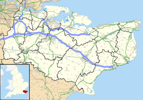
Basted est une hameau dans le district de Sevenoaks, dans le comté du Kent.
Villes et communes voisines
 |
Ightham (Village) |
Borough Green (Village) |
Platt |
 |
| Sevenoaks(Ville) |
N |
Crouch (Hameau),
Claygate Cross (Hameau) |
| O Basted E |
| S |
Shipbourne,
Ivy Hatch |
Dunk's Green,
Plaxtol |
West Peckham |
Transport
Chemin de fer
- Borough Green & Wrotham railway station
Routes
Wikimedia Foundation.
2010.
Contenu soumis à la licence CC-BY-SA. Source : Article Basted (Kent) de Wikipédia en français (auteurs)
Regardez d'autres dictionnaires:
River Bourne, Kent — For an explanation of the various pieces of machinery mentioned, see Mill machinery. River Bourne The River Bourne enters the Medway Origin Ightham … Wikipedia
Platt, Kent — infobox UK place static country = England official name= Platt latitude= 51.286580 longitude= 0.335400 population = shire district= Tonbridge and Malling shire county = Kent region= South East England constituency westminster= post town= postcode … Wikipedia
Medway watermills (middle tributaries) — For an explanation of the various pieces of machinery mentioned, see Mill machinery. River Medway (Middle Tributaries) Legend … Wikipedia
Medway watermills diagram — A diagram of the River Medway and its watermills. Due to the size of the diagram it is shown separately to the main article Medway watermills. Watermills of the River Medway and its tributaries Legend … Wikipedia
Borough Green — infobox UK place country = England official name= Borough Green latitude= 51.291300 longitude= 0.306200 population = shire district= Tonbridge and Malling shire county = Kent region= South East England constituency westminster= Tonbridge and… … Wikipedia
Claygate Cross — Star Point, Claygate Cross, built in 1839. Claygate Cross is a hamlet in the Sevenoaks District, in the English county of Kent. Contents … Wikipedia
Crouch, Sevenoaks — Crouch (as in Peter Crouch) is a hamlet in the Sevenoaks District, in the English county of Kent. Contents 1 Location 2 Transport 3 References Location It is near the large town of Seveno … Wikipedia
Claygate Cross — Star Point, Claygate Cross, construit en 1839. Administration … Wikipédia en Français
Crouch (Sevenoaks) — Crouch Administration Pays Angleterre … Wikipédia en Français
 Angleterre

