Baoro
- Baoro
-
Baoro est une ville de République centrafricaine située dans la préfecture de Nana-Mambéré dont elle constitue l'une des trois sous-préfectures.
Géographie
Cette section est vide, insuffisamment détaillée ou incomplète.
Votre aide est la bienvenue !
Histoire
Cette section est vide, insuffisamment détaillée ou incomplète.
Votre aide est la bienvenue !
Économie
Cette section est vide, insuffisamment détaillée ou incomplète.
Votre aide est la bienvenue !
Notes et références
|
|
| Bamingui-Bangoran |
Bamingui, Ndélé |
| Bangui |
Bangui |
| Basse-Kotto |
Alindao, Kembé, Mingala, Mobaye |
| Haut-Mbomou |
Djemah, Obo, Zémio |
| Haute-Kotto |
Bria, Ouadda, Yalinga |
| Kémo |
Dékoa, Sibut |
| Lobaye |
Boda, Mbaïki, Mongoumba |
| Mambéré-Kadéï |
Berbérati, Carnot, Gamboula |
| Mbomou |
Bakouma, Bangassou, Gambo-Ouango, Rafaï |
| Nana-Grébizi |
Kaga-Bandoro, Mbrès |
| Nana-Mambéré |
Baboua, Baoro, Bouar |
| Ombella-M'Poko |
Bimbo, Boali, Damara, Yaloké-Bossembélé |
| Ouaka |
Bakala, Bambari, Grimari, Ippy, Kouango |
| Ouham |
Batangafo, Bossangoa, Bouca, Kabo, Markounda |
| Ouham-Pendé |
Bocaranga, Bozoum, Paoua |
| Sangha-Mbaéré |
Bambio, Nola |
| Vakaga |
Birao, Ouanda Djallé |
Catégorie :
- Ville de la République centrafricaine
Wikimedia Foundation.
2010.
Contenu soumis à la licence CC-BY-SA. Source : Article Baoro de Wikipédia en français (auteurs)
Regardez d'autres dictionnaires:
Baoro — Original name in latin Baoro Name in other language Baoro, Baoro Boubangoui, Baoro Boudinghe, Baoro Boudingh State code CF Continent/City Africa/Bangui longitude 5.66667 latitude 15.96667 altitude 728 Population 6319 Date 2013 06 07 … Cities with a population over 1000 database
Baoro — Infobox Settlement official name = PAGENAME other name = native name = nickname = settlement type = motto = imagesize = image caption = flag size = image seal size = image shield = shield size = image blank emblem = blank emblem type = blank… … Wikipedia
Baoro Sub-Prefecture — Admin ASC 2 Code Orig. name Baoro Sub Prefecture Country and Admin Code CF.09.7732103 CF … World countries Adminstrative division ASC I-II
List of Central African Republic-related topics — This is a list of topics related to Central African Republic. Those interested in the subject can monitor changes to the pages by clicking on Related changes in the sidebar. Central African RepublicBuildings and structures in the Central African… … Wikipedia
Bangui — Centre de Bangui Administration Pays … Wikipédia en Français
Villes de la Republique centrafricaine — Villes de la République centrafricaine Carte de la République centrafricaine Rang Ville Population Préfecture Cens. 1975 … Wikipédia en Français
Villes de la République centrafricaine — Carte de la République centrafricaine Rang Ville Population Préfecture Cens. 1975 … Wikipédia en Français
Villes de la république centrafricaine — Carte de la République centrafricaine Rang Ville Population Préfecture Cens. 1975 … Wikipédia en Français
Sous-préfectures de République centrafricaine — Les préfectures de République centrafricaine sont divisées en 71 sous préfectures listées ci dessous par préfectures. Sommaire 1 … Wikipédia en Français
Communications in the Central African Republic — Telephone Network* The national network for fixed phones consists of some Panaftel microwave radio relay links (from Bangui to Bossembele, Baoro, Carnot, Berberati and on to Gamboula on the border with Cameroon). This microwave network has… … Wikipedia
 République centrafricaine
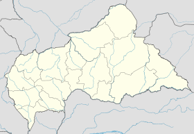
 Baoro
Baoro