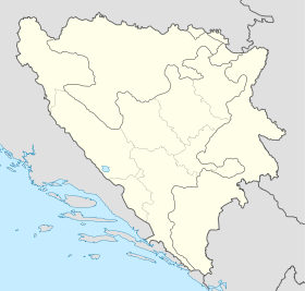
- Baljkovica
-
Baljkovica
БаљковицаAdministration Pays  Bosnie-Herzégovine
Entité  Fédération de Bosnie-et-Herzégovine et
  République serbe de Bosnie
Municipalité Sapna et Zvornik Géographie Coordonnées Démographie Population 595 hab. (1991) Localisation Baljkovica (en serbe cyrillique : Баљковица) est un village de Bosnie-Herzégovine. Il est situé en partie dans la municipalité de Zvornik, République serbe de Bosnie, et en partie dans la municipalité de Sapna, Fédération de Bosnie-et-Herzégovine. Au recensement de 1991, il comptait 595 habitants, dont une majorité de Serbes[1].
Sommaire
Histoire
À la suite des accords de Dayton, une partie du village de Baljkovica, c'est-à-dire les hameaux de Muhamedbegovici et de Tijanici, a été rattachée à la municipalité de Sapna, intégrée à la Fédération de Bosnie-et-Herzégovine[2].
Démographie
Répartition de la population (1991)
Nationalité Nombre % Serbes 451 75,98 Musulmans 141 23,70 Croates 2 0,34 Inconnus/autres 1 0,17[1] En 1991, la communauté locale de Baljkovica comptait 939 habitants, répartis de la manière suivante[3] :
Nationalité Nombre % Serbes 468 49,84 Musulmans 466 49,63 Croates 2 0,21 Inconnus/autres 3 0,32 Notes et références
- (bs)(hr)(sr) Livre : Composition nationale de la population - Résultats de la République par municipalités et localités 1991, Bulletin statistique n°234, Publication de l'Institut national de statistique de Bosnie-Herzégovine, Sarajevo.
- (bs) Geografija sur http://opcinasapna.ba, Site officiel de la municipalité de Sapna. Consulté le 21 octobre 2009
- (bs)(hr)(sr)[PDF] Recensement par communautés locales sur http://www.fzs.ba, Bosnie-Herzégovine - Fédération de Bosnie-et-Herzégovine - Institut fédéral de statistique. Consulté le 11 octobre 2010
Voir aussi
Articles connexes
Liens externes
- (en) Maplandia
- (en) Baljkovica sur fallingrain.com
Catégories :- Localité de Sapna
- Localité de la Fédération de Bosnie-et-Herzégovine à majorité serbe
- Localité de Zvornik
Wikimedia Foundation. 2010.

