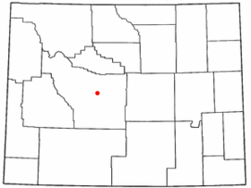
Arapahoe (Wyoming)
Contenu soumis à la licence CC-BY-SA. Source : Article Arapahoe (Wyoming) de Wikipédia en français (auteurs)
Regardez d'autres dictionnaires:
Arapahoe, Wyoming — Infobox Settlement official name = Arapahoe, Wyoming settlement type = CDP nickname = motto = imagesize = image caption = image mapsize = 250x200px map caption = Location of Arapahoe, Wyoming mapsize1 = map caption1 = subdivision type = Country… … Wikipedia
Arapahoe — ist die Bezeichnung mehrerer Orte in den Vereinigten Staaten: Arapahoe (Colorado) Arapahoe (Nebraska) Arapahoe (North Carolina) Arapahoe (Oklahoma) Arapahoe (Wyoming) Arapahoe oder Arapaho ist außerdem der Name eines nordamerikanischen… … Deutsch Wikipedia
Wyoming locations by per capita income — Wyoming has the thirty sixth highest per capita income in the United States of America, at $19,134 (2000). Its personal per capita income is $32,808 (2003). Wyoming counties ranked by per capita income There are twenty three counties located in… … Wikipedia
Arapahoe — Arapahoe, WY U.S. Census Designated Place in Wyoming Population (2000): 1766 Housing Units (2000): 498 Land area (2000): 31.350128 sq. miles (81.196455 sq. km) Water area (2000): 0.228668 sq. miles (0.592247 sq. km) Total area (2000): 31.578796… … StarDict's U.S. Gazetteer Places
Arapahoe, WY — U.S. Census Designated Place in Wyoming Population (2000): 1766 Housing Units (2000): 498 Land area (2000): 31.350128 sq. miles (81.196455 sq. km) Water area (2000): 0.228668 sq. miles (0.592247 sq. km) Total area (2000): 31.578796 sq. miles… … StarDict's U.S. Gazetteer Places
Arapahoe High School (Centennial, Colorado) — Infobox School name = Arapahoe High School imagesize = 200 caption = Arapahoe Warrior streetaddress = 2201 East Dry Creek Road city = Centennial state = Colorado country = USA zipcode = 80122 3100 motto = established = 1964 type = Free public… … Wikipedia
Arapahoe — noun 1. a member of a tribe of Plains Indians formerly inhabiting eastern Colorado and Wyoming (now living in Oklahoma and Wyoming) • Syn: ↑Arapaho • Hypernyms: ↑Algonquian, ↑Algonquin, ↑Plains Indian, ↑Buffalo Indian 2. the Algonquian language… … Useful english dictionary
Arapahoe — Arapahos Pour les articles homonymes, voir Arapahos (homonymie). Scabby Bull, Arapaho … Wikipédia en Français
List of high schools in Wyoming — This is a list of high schools in the state of Wyoming.Albany County*Laramie High School, Laramie *Rock River High School, Rock River *Whiting High School, LaramieBig Horn County*Burlington High School, Burlington *Greybull High School, Greybull… … Wikipedia
National Register of Historic Places listings in Arapahoe County, Colorado — Location of Arapahoe County in Colorado This is a list of the National Register of Historic Places listings in Arapahoe County, Colorado. It is intended to be a complete list of the properties and districts on the National Register of Historic… … Wikipedia
 Pour les articles homonymes, voir Arapaho.
 États-Unis
 Wyoming


