Barnstable County, Massachusetts
- Barnstable County, Massachusetts
-
Comté de Barnstable
| Comté de Barnstable |
|
 |
| Administration |
| Pays |
 États-Unis États-Unis |
| État |
Massachusetts |
| Chef-lieu |
Barnstable |
| Fondation |
1685 |
| Caractéristiques |
| Superficie |
| Totale |
3 382 km² |
| Terre |
1 024 km² |
| Eau |
2 358 km² (69,72 %) |
| Population |
| Totale (recens. 2000) |
222 230 hab. |
| Densité |
217,02 hab./km² |
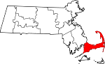
Le comté de Barnstable est un comté de l'État du Massachusetts aux États-Unis. Au recensement de 2000, il comptait 222 230 habitants. Son chef-lieu est la ville de Barnstable. Le comté couvre l'ensemble de la péninsule de Cap Cod.
Villes du comté
Liens internes
Liens externes
 Portail des États-Unis
Catégories : Comté du Massachusetts | Comté de Barnstable
Wikimedia Foundation.
2010.
Contenu soumis à la licence CC-BY-SA. Source : Article Barnstable County, Massachusetts de Wikipédia en français (auteurs)
Regardez d'autres dictionnaires:
Barnstable County, Massachusetts — Infobox U.S. County county = Barnstable County state = Massachusetts map size = 225 founded = 1685 seat = Barnstable | area total sq mi = 1306 area total km2 = 3382 area land sq mi = 396 area land km2 = 1024 area water sq mi = 910 area water km2 … Wikipedia
National Register of Historic Places listings in Barnstable County, Massachusetts — Location of Barnstable County in Massachusetts This is a list of the National Register of Historic Places listings in Barnstable County, Massachusetts. This is intended to be a complete list of the properties and districts on the National… … Wikipedia
Historical U.S. Census Totals for Barnstable County, Massachusetts — This article shows U.S. Census totals for Barnstable County, Massachusetts, broken down by municipality, from 1900 to 2000.Like most areas of New England, Barnstable County is (and has been at all times since well before the 20th century)… … Wikipedia
List of Registered Historic Places in Barnstable County, Massachusetts — List of Registered Historic Places in Barnstable County, Massachusetts: :: Massachusetts NRHP date for lists ee also*List of National Historic Landmarks in MassachusettsReferences … Wikipedia
Pine Hill (Barnstable County, Massachusetts) — Infobox Mountain Name = Pine Hill Photo = Summit of Pine Hill, Bourne, MA.jpg Photo size = Caption = Summit of Pine Hill pushpin pushpin label position = pushpin map caption = pushpin mapsize = coordinates ref= latd=41 |latm=42 |lats=31 |latNS=N… … Wikipedia
Barnstable (village), Massachusetts — Barnstable Harbor, November 2002 Barnstable is the name of one of the seven villages within the Town of Barnstable, Massachusetts. The Village of Barnstable is located on the north side of the town, centered along Old King s Highway (Route 6A),… … Wikipedia
Barnstable County — Verwaltung US Bundesstaat: Massachusetts Verwaltungssitz: Barnstable Gründung: 1685 Demographie Einwohner: 226.514 … Deutsch Wikipedia
Dukes County, Massachusetts — Seal … Wikipedia
Barnstable County Courthouse — Infobox nrhp | name =Barnstable County Courthouse nrhp type = caption = location= Barnstable, Massachusetts lat degrees = 41 lat minutes = 42 lat seconds = 5 lat direction = N long degrees = 70 long minutes = 18 long seconds = 17 long direction … Wikipedia
USS Barnstable County (LST-1197) — was named after Barnstable County, Massachusetts. She was laid down on 19 December 1970 at San Diego, California, by the National Steel and Shipbuilding Corporation; launched on 2 October, 1971. Commander. Warren R. Ellsworth was in… … Wikipedia
