Ancoats

Ancoats

53° 29′ 00″ N 2° 13′ 47″ W / 53.4833, -2.22972

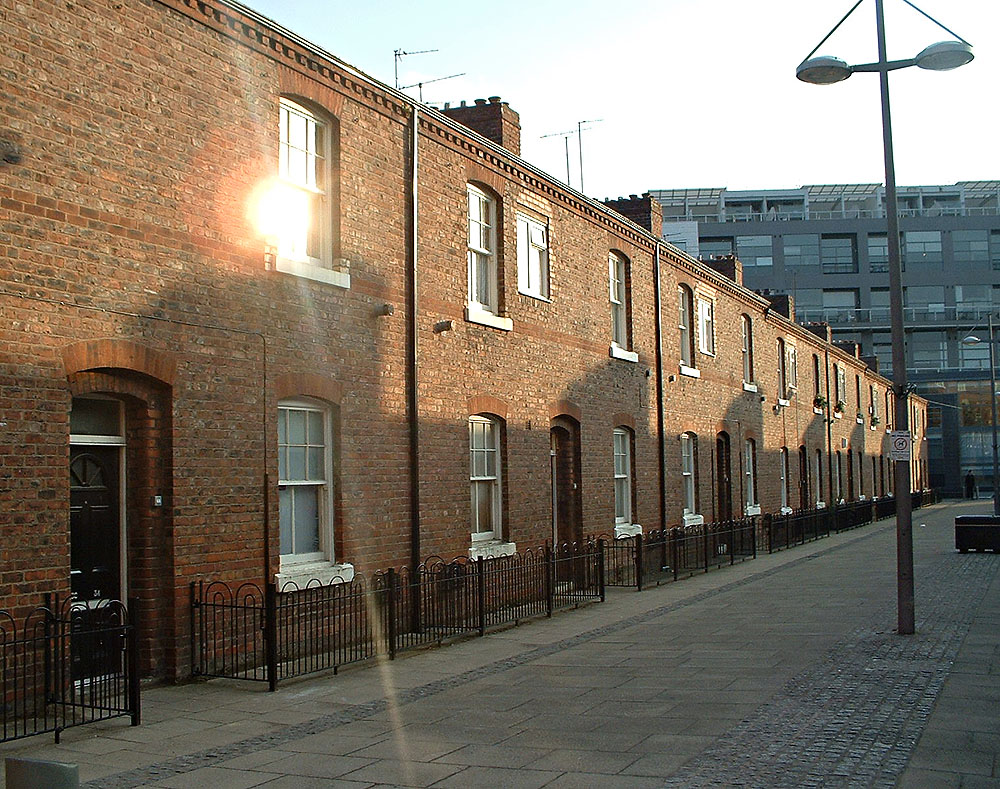
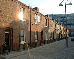
Ancoats est une ancienne cité industrielle transformée en zone résidentielle

Ancoats est un secteur de la ville de Manchester, au nord-ouest de l'Angleterre, située près du quartier nord de la ville.

Appartenant historiquement au Lancashire, Ancoats devient l'un des berceaux de la révolution industrielle et est surnommée « la première banlieue industrielle du monde »[1]. Pendant plusieurs années à partir du XVIIIe siècle, Ancoats est un district industriel florissant. Mais la zone souffre d'un fort déclin économique à partir des années 1930, et de dépopulation après la Seconde Guerre mondiale, particulièrement au cours des années 1960.

Depuis les années 1990, le patrimoine industriel d'Ancoats est reconnu, et avec la proximité du centre ville, cela conduit à la mise en place d'un plan de restructuration d'envergure. La partie sud de la banlieue, est renommée New Islington, tandis que la partie nord conserve le nom d'Ancoats centrant son développement nouveau autour du Daily Express Building.

Pour les élections locales, Ancoats fait partie de la division d'Ancoats and Clayton.

Références

  1. Explore Manchester, Pevsner Architectural Guides. Consulté le 22 mai 2007

Wikimedia Foundation. 2010.

Contenu soumis à la licence CC-BY-SA. Source : Article Ancoats de Wikipédia en français (auteurs)

Игры ⚽ Поможем написать курсовую

Regardez d'autres dictionnaires:

  • Ancoats — Infobox UK place country = England map type= Greater Manchester official name= Ancoats latitude= 53.483333 longitude= 2.229722 population= metropolitan borough= City of Manchester metropolitan county= Greater Manchester region = North West… …   Wikipedia

  • Ancoats and Clayton — is an electoral district or ward in the north of the City of Manchester in North West England. It includes the Ancoats and Clayton districts. Voters from this ward elect three councillors to Manchester City Council. Mike Carmody, Jim Battle… …   Wikipedia

  • Ancoats Hospital — The Ancoats Hospital was a large inner city hospital, located in Ancoats, to the north of Manchester, England, city centre. The hospital was built in 1873 to serve the densely populated districts of north and east Manchester. Located between Old… …   Wikipedia

  • Ancoats — noun an area of Manchester, England …   Wiktionary

  • Sir Oswald Mosley, 2nd Baronet, of Ancoats — Sir Oswald Mosley, 2nd Baronet (27 March 1785 ndash; 24 May 1871) was a politician in the United Kingdom. He was Member of Parliament (MP) for Portarlington 1806 1807, Winchelsea 1807 1812, Midhurst 1817 1818 and Staffordshire North 1832… …   Wikipedia

  • Murrays' Mills — Murray Mills redirects here. For the bishop, see Murray Mills (bishop). Murrays Mills New Mill in 2008, part of the Murrays Mills complex …   Wikipedia

  • Northern Quarter (Manchester) — Coordinates: 53°28′56″N 2°14′04″W / 53.482289°N 2.23435°W / 53.482289; 2.23435 …   Wikipedia

  • McConnel & Kennedy mills — McConnel and Kennedy Mills Location Ancoats [1] …   Wikipedia

  • Ashton Canal — The Ashton Canal is a canal built in Greater Manchester in Northern England.RouteThe Ashton leaves the Rochdale Canal at Ducie St. Junction in central Manchester, and climbs for six miles (10 km) and 18 locks, passing through Ancoats, Holt Town,… …   Wikipedia

  • Mosley Baronets — There have been three Baronetcies created for members of the Mosley family, one in the Baronetage of England and two in the Baronetage of Great Britain. One creation is extant as of 2008. The Mosley Baronetcy, of Rolleston in the County of… …   Wikipedia

Share the article and excerpts

Direct link
Do a right-click on the link above
and select “Copy Link”