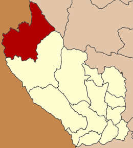
Amphoe Sangkhla Buri
Contenu soumis à la licence CC-BY-SA. Source : Article Amphoe Sangkhla Buri de Wikipédia en français (auteurs)
Regardez d'autres dictionnaires:
Amphoe Sangkhla Buri — Sangkhlaburi สังขละบุรี Provinz: Kanchanaburi Fläche: 3349,4 km² Einwohner: 42.236 (2007) Bev.dichte: 13 E./km² PLZ: 71240 … Deutsch Wikipedia
Amphoe Sangkhla Buri — Admin ASC 2 Code Orig. name Amphoe Sangkhla Buri Country and Admin Code TH.50.1150734 TH … World countries Adminstrative division ASC I-II
Amphoe Sangkhla Buri — Infobox Amphoe name=Sangkhla Buri thai=สังขละบุรี province=Kanchanaburi coordinates=coord|15|9|20|N|98|27|12|E|type:adm2nd region:TH capital=Nong Lu area=3,349.4 population=40,162 population as of=2005 density=12.0 postal code=71240… … Wikipedia
Sangkhla Buri — Sangkhlaburi สังขละบุรี Provinz: Kanchanaburi Fläche: 3349,4 km² Einwohner: 42.236 (2007) Bev.dichte: 13 E./km² PLZ: 71240 … Deutsch Wikipedia
Sangkhla Buri — Original name in latin Sangkhla Buri Name in other language Amphoe Sangkhla Buri, Amphoe Wang Ka, Ban Wang Ga, Ban Wang Kabon, Ban Wangka, Bn Wang Ga, King Amphoe Sangkhla, King Amphoe Sangkhla Buri, Sang Kla Buri, Sangkhla, Sangkhla Buri,… … Cities with a population over 1000 database
Amphoe Thong Pha Phum — Thong Pha Phum ทองผาภูมิ Provinz: Kanchanaburi Fläche: 3655,2 km² Einwohner: 64.784 (2007) Bev.dichte: 18 E./km² PLZ: 7118 … Deutsch Wikipedia
Amphoe Thong Pha Phum — Infobox Amphoe name=Thong Pha Phum thai=ทองผาภูมิ province=Kanchanaburi coordinates=coord|14|44|45|N|98|37|30|E|type:adm2nd region:TH capital=Tha Khanun area=3,655.171 population=62,848 population as of=2005 density=17.2 postal code=71180 geocode … Wikipedia
Amphoe Umphang — Infobox Amphoe name=Umphang thai=อุ้มผาง province=Tak coordinates=coord|16|1|0|N|98|51|46|E|type:adm2nd region:TH area=4,325.4 population=25,757 population as of=2005 density=6.0 postal code=63170 geocode=6308Umphang ( th. อุ้มผาง) is the… … Wikipedia
Amphoe — An amphoe (sometimes also amphur, Thai: อำเภอ, [ʔāmpʰɤ̄ː]) is the second level administrative subdivision of Thailand. Usually translated as district, amphoe make up the provinces, and are analogous to a county seat. Amphoe are further subdivided … Wikipedia
Amphoe Umphang — Umphang อุ้มผาง Provinz: Tak Fläche: 4.325,4 km² Einwohner: 25.757 (2005) Bev.dichte: 6 E./km² PLZ: 63170 … Deutsch Wikipedia

 Thaïlande