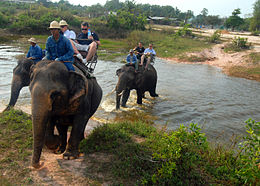
Amphoe Bang Lamung
Contenu soumis à la licence CC-BY-SA. Source : Article Amphoe Bang Lamung de Wikipédia en français (auteurs)
Regardez d'autres dictionnaires:
Amphoe Bang Lamung — Bang Lamung บางละมุง Provinz: Chonburi Fläche: 469 km² Einwohner: 1.172.432 (2548) Bev.dichte: 2499,8 E./km² PLZ: 20150 … Deutsch Wikipedia
Amphoe Bang Lamung — Admin ASC 2 Code Orig. name Amphoe Bang Lamung Country and Admin Code TH.46.1619422 TH … World countries Adminstrative division ASC I-II
Amphoe Bang Lamung — Infobox Amphoe name=Bang Lamung thai=บางละมุง province=Chonburi coordinates=coord|12|58|36|N|100|54|48|E|type:adm2nd region:TH capital=Na Kluea area=173.0 population=212,568 population as of=2005 density=1228.7 postal code=20150 geocode=2004Bang… … Wikipedia
Bang Lamung — บางละมุง Provinz: Chonburi Fläche: 469 km² Einwohner: 1.172.432 (2548) Bev.dichte: 2499,8 E./km² PLZ: 20150 … Deutsch Wikipedia
Bang Lamung — Original name in latin Bang Lamung Name in other language Amphoe Ban Lamung, Amphoe Bang Lamung, Amphoe Naklua, Ban Na Kloea, Ban Na Glua, Ban Naklua, Bang La muang, Bang Lamung, Na Klua, banglamung State code TH Continent/City Asia/Bangkok… … Cities with a population over 1000 database
Amphoe Si Racha — Infobox Amphoe name=Si Racha thai=ศรีราชา province=Chonburi coordinates=coord|13|10|28|N|100|55|50|E|region:TH type:adm2nd area=616.4 population=167,896 population as of=2000 density=272 postal code=20110 geocode=2007Amphoe Si Racha (also Sri… … Wikipedia
Amphoe Nikhom Patthana — Nikhom Phatthana นิคมพัฒนา Provinz: Rayong Fläche: 237,5 km² Einwohner: 32.482 (2005) Bev.dichte: 136,8 E./km² PLZ: 21180 … Deutsch Wikipedia
Amphoe Nikhom Phatthana — Nikhom Phatthana นิคมพัฒนา Provinz: Rayong Fläche: 237,5 km² Einwohner: 32.482 (2005) Bev.dichte: 136,8 E./km² PLZ: 21180 … Deutsch Wikipedia
Amphoe Pluak Daeng — Pluak Daeng ปลวกแดง Provinz: Rayong Fläche: 237,5 km² Einwohner: 34.878 (2005) Bev.dichte: 146,9 E./km² PLZ: 21140 … Deutsch Wikipedia
Amphoe Si Racha — Si Racha ศรีราชา Provinz: Chonburi Fläche: 616,4 km² Einwohner: 167.896 (2000) Bev.dichte: 272 E./km² PLZ: 20110 … Deutsch Wikipedia


 Thaïlande