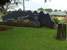
Alstonville
Contenu soumis à la licence CC-BY-SA. Source : Article Alstonville de Wikipédia en français (auteurs)
Regardez d'autres dictionnaires:
Alstonville Country Cottages — (Alstonville,Австралия) Категория отеля … Каталог отелей
Alstonville Settlers Motel — (Alstonville,Австралия) Категория отеля: 3,5 звезд Адрес: 188 190 Ballina … Каталог отелей
Alstonville, New South Wales — Infobox Australian Place | type = town name = Alstonville state = nsw lga = Ballina Shire Council postcode = 2477 pop = 5,006 pop footnotes=Census 2006 AUS|id=UCL101000|name=Alstonville (Urban Centre/Locality)|accessdate=2008 01 08|quick=on]… … Wikipedia
Alstonville — /ˈɔlstənvɪl/ (say awlstuhnvil) noun a town near Ballina in northern NSW; noted timber growing area. Formerly, Duck Creek Mountain …
List of Government schools in New South Wales: A–F — The New South Wales Department of Education and Training (DET) is a department of the Government of New South Wales. In addition to other responsibilities, it operates primary schools and secondary schools throughout the state. Contents 1 A 2 B 3 … Wikipedia
Bruxner Highway — Infobox Australian Road road name = Bruxner Highway route route route photo = caption = Proposed .] length = 413 direction = West East start = finish = est = through = Yetman, Bonshaw, Tenterfield, Drake, Tabulam, Casino, Lismore, Alstonville… … Wikipedia
Wollongbar, New South Wales — Infobox Australian Place | type = town name = Wollongbar state = nsw lga = Ballina Shire Council postcode = 2477 pop = 1,846 pop footnotes=Census 2006 AUS|id=UCL184600|name=Wollongbar (Urban Centre/Locality)|accessdate=2008 01 08|quick=on]… … Wikipedia
Comté de Ballina — 28°50′S 153°32′E / 28.833, 153.533 … Wikipédia en Français
Bruxner Highway — bei Drake. Der … Deutsch Wikipedia
Alstonvale — Administration Pays Australie … Wikipédia en Français
 Australie

