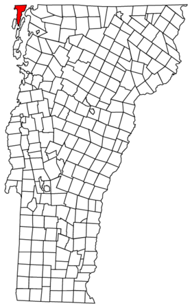
Alburgh (village)
Contenu soumis à la licence CC-BY-SA. Source : Article Alburgh (village) de Wikipédia en français (auteurs)
Regardez d'autres dictionnaires:
Alburgh (village), Vermont — Alburgh is a village in Grand Isle County, Vermont, United States. The population was 488 at the 2000 census. The town s name came from the person primarily responsible for chartering the community, Ira Allen. History The community was chartered… … Wikipedia
Alburgh (town), Vermont — This article is about the town in Vermont. For the village, see Alburgh (village), Vermont Alburgh (formerly Alburg ) is a town in Grand Isle County, Vermont, United States, founded in 1781 by Ira Allen. The population was 1,952 at the 2000… … Wikipedia
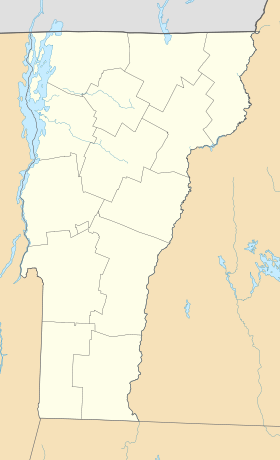
Alburgh (Vermont) — 44° 57′ 29″ N 73° 17′ 30″ W / 44.958056, 73.291667 … Wikipédia en Français
Alburgh (Vermont) — Alburgh … Deutsch Wikipedia
Alburgh — infobox UK place country = England static static image caption= latitude= 52.42 longitude=01.04 official name=Alburgh population = shire district= South Norfolk shire county= Norfolk region= East of England constituency westminster= South Norfolk … Wikipedia
Burlington-South Burlington metropolitan area — The Burlington South Burlington Metropolitan Statistical Area, as defined by the United States Census Bureau, is an area consisting of three counties in northwestern Vermont, anchored by the cities of Burlington and South Burlington and… … Wikipedia
List of enclaves and exclaves — In political geography, an enclave is a piece of land which is totally surrounded by a foreign territory, and an exclave is one which is politically attached to a larger piece but not actually contiguous with it. Many entities are both enclaves… … Wikipedia
Lake Champlain — For ships named after the lake, see USS Lake Champlain. Lake Champlain Lake Champlain near Burlington in early twilight Location New … Wikipedia
List of schools in the East of England — The following is a partial list of currently operating schools in the East region of England. You may also find of use to find a particular school. See also the List of the oldest schools in the United Kingdom.Listed by local education authority… … Wikipedia
Denton, Norfolk — Coordinates: 52°26′46″N 1°21′20″E / 52.446175°N 1.355438°E / 52.446175; 1.355438 … Wikipedia
 États-Unis
 Vermont