Aberfeldy (village)
- Aberfeldy (village)
-
Wikimedia Foundation.
2010.
Contenu soumis à la licence CC-BY-SA. Source : Article Aberfeldy (village) de Wikipédia en français (auteurs)
Regardez d'autres dictionnaires:
Aberfeldy — ABERFELDY, a village, chiefly in the parish of Dull, and partly in that of Logierait, county of Perth, 6½ miles (N. E.) from Kenmore; containing 823 inhabitants. This is a considerable and thriving village, situated on the southern bank of the … A Topographical dictionary of Scotland
Aberfeldy, Scotland — infobox UK place country = Scotland official name= Aberfeldy scots name= gaelic name= population= 1,895 [cite web|publisher=Scotland s Census Results Online|title =Comparative Population Profile: Aberfeldy Locality |… … Wikipedia
Aberfeldy railway station — Infobox UK disused station name = Aberfeldy caption = locale = Scotland borough = Highland Railway line = Inverness and Perth Junction Railway owner = London, Midland and Scottish Railway platforms = ? latitude = longitude = gridref = years = 3… … Wikipedia
Aberfeldy — Cette page d’homonymie répertorie les différents sujets et articles partageant un même nom. Aberfeldy peut faire référence : au village d Aberfeldy à la distillerie d Aberfeldy un groupe de musiciens Écossais Catégorie : Homonymie … Wikipédia en Français
Dull — DULL, a parish, in the county of Perth, 4 miles (W. by N.) from Aberfeldy; containing, with parts of the late quoad sacra parishes of Foss and Tenandry, and part of the village of Aberfeldy, 3811 inhabitants, of whom 145 are in the village of… … A Topographical dictionary of Scotland
Weem — WEEM, a parish, in the county of Perth, 1 mile (N. W.) from Aberfeldy; containing, with the hamlets of Balnasuim, Caolvallock, Kirkton of Weem, Balwahanaid, Cragganester, Craggantoul, and Tombreck, and part of the quoad sacra parish of… … A Topographical dictionary of Scotland
Logierait — LOGIERAIT, a parish, in the county of Perth, containing, with the village of Ballenluig, part of that of Aberfeldy, and part of the late quoad sacra district of Rannoch, 2959 inhabitants, of whom 168 are in the village of Logierait, 8 miles (N … A Topographical dictionary of Scotland
Old military roads of Scotland — The remains of one of the military roads near the Corrieyairack Pass A network of military roads was constructed in the Scottish Highlands during the middle part of the 18th century as part of an attempt by the British Government to bring order… … Wikipedia
Loch Lomond and the Trossachs National Park — Infobox protected area | name = Loch Lomond and The Trossachs National Park iucn category = II caption = Looking eastwards along Loch Katrine in the Loch Lomond and the Trossachs National Park locator x = locator y = location = Scotland, Argyll… … Wikipedia
J. K. Rowling — J. K. Rowling … Wikipedia
 Pour les articles homonymes, voir Aberfeldy.
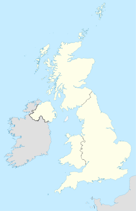
 Royaume-Uni
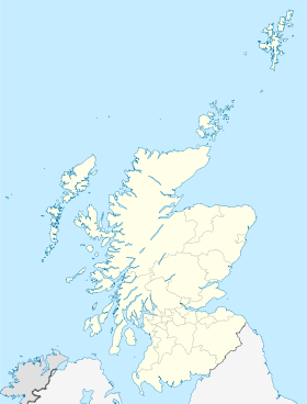
 Aberfeldy