Ballyshannon
- Ballyshannon
-
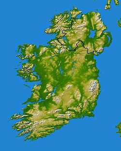
Ballyshannon (Béal Átha Seanaidh en irlandais) est une ville du comté de Donegal en République d'Irlande.
Elle est située à l'embouchure de l'Erne.
La ville de Ballyshannon compte 2 686 habitants.
Personnalités
- James Dever (1825-1904), homme politique canadien
- Rory Gallagher (2 mars 1948 -14 juin 1995), guitariste et chanteur de blues/rock.
Voir aussi
Article connexe
Wikimedia Foundation.
2010.
Contenu soumis à la licence CC-BY-SA. Source : Article Ballyshannon de Wikipédia en français (auteurs)
Regardez d'autres dictionnaires:
Ballyshannon — (spr. Bällischännen), Stadt am Erne (mit 15 Fuß hohem Fall) in der irischen Provinz Ulster, Grafschaft Donegal, Handel mit Getreide, Leinwand, Fischen (Lachse u. Aale), 9000 Ew. Höhle in der Nachbarschaft, das Fegefeuer des St. Patrik genannt … Pierer's Universal-Lexikon
Ballyshannon — (spr. bällĭschännen), Stadt in der irischen Grafschaft Donegal, an der Mündung des Erne in die Donegalbai, mit (1891) 2471 Einw. und ansehnlicher Fischerei … Meyers Großes Konversations-Lexikon
Ballyshannon — (spr. bällischänn n), Hafenstadt in der irischen Grafsch. Donegal, am Erne, (1891) 2471 E … Kleines Konversations-Lexikon
Ballyshannon — (Bällischänʼn), irische Stadt in der Provinz Ulster, 4000 E., Hafen, Linnenfabrikation, Aal und Lachsfang; in der Nähe die Höhle: das Fegfeuer des hl. Patrik … Herders Conversations-Lexikon
Ballyshannon — Infobox Irish Place name = Ballyshannon gaeilge = Béal Átha Seanaidh crest map pin coords = left: 51px; top: 112px north coord = 54.5015 west coord = 8.2018 irish grid = G874616 county = County Donegal dailconstituency = Donegal South EU… … Wikipedia
Ballyshannon — Der Fluss Erne in Ballyshannon Ballyshannon (irisch: Béal Átha Seanaidh) ist ein Ort im äußersten Süden des County Donegal im Nordwesten Irlands mit 3.486 Einwohnern (2011). Jüngst wurde dort eine futuristisch anmutende Brücke über den Erne… … Deutsch Wikipedia
Ballyshannon — Original name in latin Ballyshannon Name in other language Ballyshannon, Beal Atha Seanaidh, Bal tha Seanaidh State code IE Continent/City Europe/Dublin longitude 54.5 latitude 8.18333 altitude 8 Population 2683 Date 2012 01 18 … Cities with a population over 1000 database
Ballyshannon — Sp Bališãnonas Ap Ballyshannon angliškai Ap Béal Átha Seanaidh airiškai L Airija … Pasaulio vietovardžiai. Internetinė duomenų bazė
Ballyshannon (Parliament of Ireland constituency) — Parliament of Ireland former constituency infobox Name = Ballyshannon Type = Borough Year = 1613 Post Union = DisfranchisedBallyshannon (also known as Ballyshannon Borough) was a constituency represented in the Irish House of Commons from 1613 to … Wikipedia
Баллишанон — (Ballyshannon) торговое местечко с 2840 жит. (1881 г.) в ирландск. провинции Ульстер, в графстве Донегаль (см. это сл.) … Энциклопедический словарь Ф.А. Брокгауза и И.А. Ефрона


