Wundanyi
- Wundanyi
-
Wundanyi est une ville kenyane située dans les monts Taita, à l'ouest de Voi. Elle est le chef-lieu du district de Taita-Taveta.
Elle est le centre d'une région agricole. L'attraction touristique locale est la forêt Ngangao, connue pour ses papillons.
Wikimedia Foundation.
2010.
Contenu soumis à la licence CC-BY-SA. Source : Article Wundanyi de Wikipédia en français (auteurs)
Regardez d'autres dictionnaires:
Wundanyi — is a town lying in the Taita Hills of southern Kenya, west of Voi. It is also the Headquarters of Taita Taveta District. The town has a population of 4000 (1999 census) [http://www.ilri.cgiar.org/html/Urban%20Poverty%20all%20Kenya%20Province%20thr… … Wikipedia
Wundanyi — Original name in latin Wundanyi Name in other language Wundanyi State code KE Continent/City Africa/Nairobi longitude 3.40193 latitude 38.36402 altitude 1396 Population 12501 Date 2013 06 28 … Cities with a population over 1000 database
Districts of Kenya — Kenya … Wikipedia
Coast Province — Province … Wikipedia
Côte (province du Kenya) — 3° 00′ S 39° 30′ E / 3, 39.5 … Wikipédia en Français
Taita-Taveta District — is one of the seventy one districts of Kenya, located in the Coast Province of that country. It lies approximately 200 km northwest of Mombasa and 360 km southeast of Nairobi city. The population of the district 30 years ago was approximately… … Wikipedia
Ngangao Forest — is one of the few remaining indigenous cloud forest fragments of the Taita Hills, Kenya. It is located on a rock surrounded by the villages of Makandenyi, Maghimbinyi, Mgambonyi and Kitumbi. It lies 10 km from Wundanyi and can easily be… … Wikipedia
Divisions of Kenya — Kenya … Wikipedia
Nairobi — City Nairobi s skyline at dusk … Wikipedia
Mombasa — Mvita redirects here. For the electoral constituency, see Mvita Constituency. Island of War redirects here. For the television series, see Island at War. For the asteroid, see 1428 Mombasa. Mombasa City … Wikipedia
 Kenya
Kenya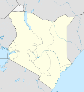
 Chogoria