Woerdense Verlaat

Woerdense Verlaat

52° 09′ 16″ N 4° 51′ 46″ E / 52.15444444, 4.86277778

Woerdense Verlaat
Administration
Pays Drapeau : Pays-Bas Pays-Bas
Province Hollande-Méridionale
Commune Nieuwkoop
Géographie
Population 303 hab. (2001)
Autres informations
Code postal 3650-3653
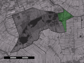
Localisation de Woerdense Verlaat dans la commune de Nieuwkoop

Woerdense Verlaat est un village néerlandais dans la commune de Nieuwkoop en Hollande-Méridionale. Le village est situé au bord des Nieuwkoopse Plassen, à l'endroit où Grecht et Kromme Mijdrecht se rencontrent.

Histoire

Le village s'est établi à partir de 1448, lorsqu'une écluse est construit dans le Grecht. Le mot verlaat indique un type d'écluse.

Jusqu'en 1989, le village appartenait à trois communes et deux provinces. Cette situation complexe a pris fin le 1er janvier 1989 : depuis, le village appartient entièrement à la commune de Nieuwkoop en Hollande-Méridionale.


Wikimedia Foundation. 2010.

Contenu soumis à la licence CC-BY-SA. Source : Article Woerdense Verlaat de Wikipédia en français (auteurs)

Игры ⚽ Нужно решить контрольную?

Regardez d'autres dictionnaires:

  • Woerdense Verlaat — Dutch town locator maps mun town caption = The town centre (dark green) and the statistical district (light green) of Woerdense Verlaat in the municipality of Nieuwkoop.Woerdense Verlaat (coord|52|9|N|4|52|E|type:city(303)) is a town in the Dutch …   Wikipedia

  • Mobile Home Chaletpark de Visotter — (Woerdense Verlaat,Нидерланды) Категория отеля: Адрес: 3652LP Wo …   Каталог отелей

  • Chalet Chaletpark de Visotter1 — (Woerdense Verlaat,Нидерланды) Категория отеля: Адрес: 3652LP Woerde …   Каталог отелей

  • Nieuwkoop —   Municipality   Nieuwkoopse Plassen …   Wikipedia

  • Nieuwkoop — Gemeinde Nieuwkoop Flagge Wappen Provinz Südholland Bürgermeiste …   Deutsch Wikipedia

  • Grecht — Caractéristiques Longueur  ? Bassin  ? Bassin collecteur Rhin Débit moyen …   Wikipédia en Français

  • Kinderdijk — Coordinates: 51°53′N 4°38′E / 51.883°N 4.633°E / 51.883; 4.633 …   Wikipedia

  • List of places in the Netherlands — This is an alphabetical list of places (cities, towns, villages) in the Netherlands. Lists per province can be found at:* List of towns in Groningen * List of towns in Friesland * List of towns in Drente * List of towns in Overijssel * List of… …   Wikipedia

  • De Adriaan, Haarlem — Windmill De Adriaan De Adriaan is a windmill in the Netherlands that burnt down in 1932 and was rebuilt in 2002. The original windmill dates from 1779 and the mill has been a distinctive part of the skyline of Haarlem for centuries. Contents …   Wikipedia

  • Achttienhoven (Hollande-Méridionale) — 52° 08′ 48″ N 4° 51′ 25″ E / 52.1467, 4.85694 …   Wikipédia en Français

Share the article and excerpts

Direct link
Do a right-click on the link above
and select “Copy Link”