Velserbroek
Contenu soumis à la licence CC-BY-SA. Source : Article Velserbroek de Wikipédia en français (auteurs)
Regardez d'autres dictionnaires:
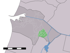
Velserbroek — Dutch town locator maps mun town caption = Velserbroek in the municipality of Velsen.Velserbroek is a town in the Dutch province of North Holland. It is a part of the municipality of Velsen.The statistical area Velserbroek , which also can… … Wikipedia
Velsen — Infobox Settlement official name = Velsen imagesize = 240px image caption = Aerial view of Velserbroek and IJmuiden flag size = 120x100px image shield = Velsen wapen.png shield size = 120x100px mapsize = 280px subdivision type = Country… … Wikipedia
Velsen — Héraldique … Wikipédia en Français
Piet van der Kuil — (1950) Pieter „Piet“ van der Kuil (* 10. Februar 1933 in Velsen) ist ein niederländischer ehemaliger Fußballspieler, der mit dem AFC Ajax aus Amsterdam Niederländischer Meister war und 40 mal in der Nationalmannschaft antrat. In … Deutsch Wikipedia
List of places in the Netherlands — This is an alphabetical list of places (cities, towns, villages) in the Netherlands. Lists per province can be found at:* List of towns in Groningen * List of towns in Friesland * List of towns in Drente * List of towns in Overijssel * List of… … Wikipedia
Bollenstreek — The Bollenstreek (Dutch for Bulb Region ) is a region in the Netherlands consisting of areas in North and South Holland that feature the cultivation of flower bulbs. The colourful flower fields that have come to symbolise Holland can be seen in… … Wikipedia
Rijksweg 22 — Vorlage:Infobox hochrangige Straße/Wartung/NL A Autosnelweg A22 in den Niederlanden Karte … Deutsch Wikipedia
Telstar (Fußballklub) — Telstar Voller Name Telstar 1963 N.V. Gegründet 17. Juli 1963 Stadio … Deutsch Wikipedia
Velsen — Gemeinde Velsen Flagge Wappen Provinz Nordholland Bürgermeister … Deutsch Wikipedia
Driehuis — 52° 26′ 50″ N 4° 38′ 12″ E / 52.4472, 4.63667 … Wikipédia en Français