1 West India Quay
- 1 West India Quay
-
51°30′25.0″N 00°01′16.7″O / 51.506944, -0.021306
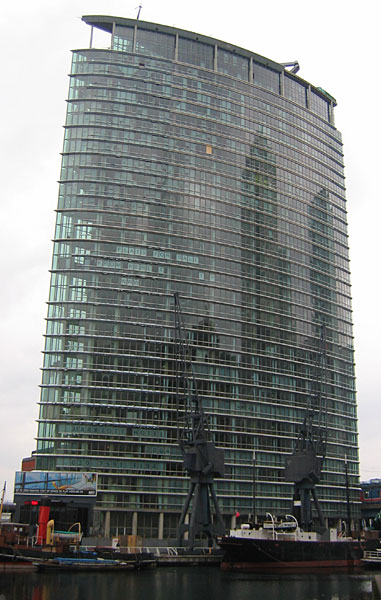
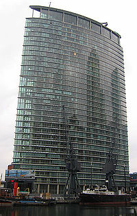
Le 1 West India Quay est un gratte-ciel de la ville de Londres, situé dans le quartier des Docklands. Construit en 2004, il est haut de 111 m et comporte 33 étages.
Il contient un hôtel Marriott jusqu'au 12e étage, puis des appartements jusqu'au 33e étage.
Lien interne
Lien externe
Catégories :
- Gratte-ciel de Londres
- Gratte-ciel mesurant entre 100 et 149 mètres
- Gratte-ciel construit en 2004
Wikimedia Foundation.
2010.
Contenu soumis à la licence CC-BY-SA. Source : Article 1 West India Quay de Wikipédia en français (auteurs)
Regardez d'autres dictionnaires:
West India Quay — is an area on the Isle of Dogs in Docklands, London, England. It is immediately to the north of the West India Docks and Canary Wharf.The 200 year old warehouse at West India Quay was used to store imported goods from the West Indies, such as tea … Wikipedia
West India Quay (DLR) — West India Quay Vue de la station Localisation District de Londres Tower Hamlets Quartier West India Quay … Wikipédia en Français
West India Quay DLR station — London stations name = West India Quay manager = Docklands Light Railway zone = 2 locale = West India Quay borough = London Borough of Tower Hamlets start=1987 platforms= 4West India Quay DLR station is a station on the Docklands Light Railway in … Wikipedia
West India Quay (DLR) — Station West India Quay West India Quay ist eine Station der Docklands Light Railway (DLR) im Londoner Stadtbezirk London Borough of Tower Hamlets. Sie liegt in der Travelcard Tarifzone 2 an den ehemaligen West India Docks, am Nordrand der Isle… … Deutsch Wikipedia
1 West India Quay — Coordinates: 51°30′25.0″N 00°01′16.7″W / 51.50694°N 0.021306°W / 51.50694; 0.021306 … Wikipedia
Marriott West India Quay — Marriott Hotel West India Quay … Wikipedia
List of east–west roads in Toronto — The following is a list of the east–west arterial thoroughfares in the Canadian city of Toronto. The city is organized in a grid pattern dating back to the plan laid out by Augustus Jones between 1793 and 1797. Most streets are aligned in the… … Wikipedia
Clarke Quay MRT Station — NE5 Clarke Quay 克拉码头地铁站 கிளார்க் கீ Stesen MRT Clarke Quay Rapid transit Interior of NE5 Clarke Quay MRT station … Wikipedia
South West Coast Path — The starting point at Minehead Length 630 miles (1,014 km) Location England: Somerset, Devon, Cornwall … Wikipedia
East West MRT Line — East West MRT Line 东西地铁线 கிழக்கு மேற்கு எம்ஆர்டி வழி The East West Line is coloured green on system maps … Wikipedia
 1 West India Quay.