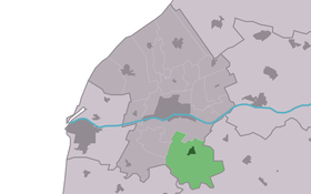
Tzum
Contenu soumis à la licence CC-BY-SA. Source : Article Tzum de Wikipédia en français (auteurs)
Regardez d'autres dictionnaires:
TZUM — Sofia ( bg. ЦУМ, abbreviated from Централен универсален магазин, Tsentralen universalen magazin , Central Department Store) is an upmarket department store in the centre of Sofia, the capital of Bulgaria, officially opened in 1957 and situated in … Wikipedia
Tzum — im Mai 2009 Tzum (fries. Tsjom) ist ein westfriesisches Dorf in den Niederlanden mit 1188 Einwohnern (Stand 2009), vier Kilometer südöstlich von Franeker, heute Teil der Gemeinde Franekeradeel. Die Ortschaft liegt auf einem zum Schutz gegen… … Deutsch Wikipedia
Tzum — Infobox Settlement official name = Tzum mapsize = 280px subdivision type = Country subdivision name = flagicon|Netherlands Netherlands subdivision type1 = Province subdivision name1 = flagicon|Friesland Friesland settlement type = Village… … Wikipedia
Tzum — Original name in latin Tzum Name in other language Tjum, Tsjom, Tzum State code NL Continent/City Europe/Amsterdam longitude 53.15899 latitude 5.56277 altitude 0 Population 1225 Date 2009 08 17 … Cities with a population over 1000 database
Reinier van Tzum — Tzum im Mai 2009 Reinier van Tzum auch Reijnjer van t Zum, (* ca. 1600 in Tzum; † 21. September 1670 in IJlst) machte im Dienst der Niederländischen Ostindien Kompanie (VOC) Karriere als Kaufmann und Leiter der Handelsniederlassungen in Siam in… … Deutsch Wikipedia
Tsjom — Tzum 53°9′28″N 5°33′52″E / 53.15778, 5.56444 … Wikipédia en Français
Largo, Sofia — Coordinates: 42°41′51.36″N 23°19′24.03″E / 42.6976°N 23.3233417°E / 42.6976; 23.3233417 … Wikipedia
List of malls in Sofia — List of the malls that are located in Sofia, Bulgaria. List of the malls (alphabetical) * Mall Boulevard (under construction) * Mall of Bulgaria (under construction) * City Center Sofia * Sky City Mall * Mall of Sofia * Mall Tsarigradski (under… … Wikipedia
Города майя — Список городов майя представляет собой алфавитный перечень важнейших археологических памятников, связанных с доколумбовой цивилизацией майя. Перечень крупнейших месоамериканских памятников иных культур, включая соседей майя, приведен в отдельном… … Википедия
De Princehofmolen, Earnewâld — Origin Mill name De Princehofmolen Mill location … Wikipedia
 Pays-Bas

