Aérodrome de Sha Tin

Aérodrome de Sha Tin
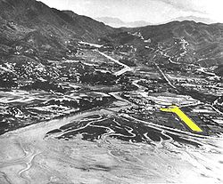
Shatinairfieldrunway.jpg
Code AITA Code OACI
Localisation
Pays Drapeau de Chine Chine
Ville desservie Hong Kong - Sha Tin
Coordonnées 22° 22′ 49″ N 114° 11′ 23″ E / 22.38024, 114.1898322° 22′ 49″ Nord
       114° 11′ 23″ Est
/ 22.38024, 114.18983
  

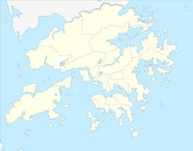
Géolocalisation sur la carte : Hong Kong

(Voir situation sur carte : Hong Kong)
Aérodrome de Sha Tin

Géolocalisation sur la carte : Chine

(Voir situation sur carte : Chine)
Aérodrome de Sha Tin
Pistes
Direction Longueur Surface
05/23 600 m (1 969 ft) Dur
Informations aéronautiques
Gestionnaire Disparu
Catégories
Aéroports • Aéroports chinois

L'Aérodrome de Sha Tin était une petite base aérienne de la Royal Air Force située près de Sha Tin dans les Nouveaux Territoires de Hong Kong et définitivement fermée au début des années 1970 alors que la RAF regroupait toutes ses activités sur le terrain de Shek Kong.


Wikimedia Foundation. 2010.

Contenu soumis à la licence CC-BY-SA. Source : Article Aérodrome de Sha Tin de Wikipédia en français (auteurs)

Игры ⚽ Поможем сделать НИР

Regardez d'autres dictionnaires:

  • RAF Sha Tin — Aérodrome de Sha Tin Aérodrome de Sha Tin Code AITA Code OACI Pays Chine Ville desservie …   Wikipédia en Français

  • Hong Kong International Airport — HKIA redirects here. HKIA may also refer to Hong Kong Institute of Architects. Hong Kong Airport redirects here. For the old airport at Kai Tak, see Kai Tak Airport. Hong Kong International Airport Chek Lap Kok Airport 香港國際機場 赤鱲角機場 …   Wikipedia

  • San Po Kong — (zh t|t=新蒲崗) is an area in New Kowloon of Hong Kong. South of Wong Tai Sin and Diamond Hill, and north of former Kai Tak International Airport, the area is bounded by Choi Hung Road and Prince Edward Road. San Po Kong is largely industrial and… …   Wikipedia

Share the article and excerpts

Direct link
Do a right-click on the link above
and select “Copy Link”