Tongariro River
- Tongariro River
-
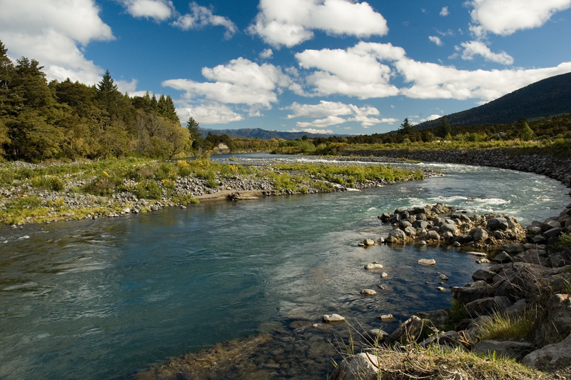
La Tongariro River est une rivière de l'Île du Nord en Nouvelle-Zélande. Elle prend naissance sur le plateau volcanique de l'Île du Nord, où elle est alimentée par de nombreux affluents (Whitikau, Poutu, ou encore Mangamawhitiwhiti). Son débit minimal est de 16 à 21 m3/s. Ce débit peut néanmoins croître de manière substantielle par la capture des précipitations au niveau du bassin versant, notamment constitué de montagnes et de hautes collines.
La Tongariro River est la rivière la plus pêchée de Nouvelle-Zélande.
Wikimedia Foundation.
2010.
Contenu soumis à la licence CC-BY-SA. Source : Article Tongariro River de Wikipédia en français (auteurs)
Regardez d'autres dictionnaires:
Tongariro River — Wassersport auf dem Oberlauf des TogariroVorlage:Infobox Fluss/KARTE fehlt … Deutsch Wikipedia
Tongariro River — The Tongariro River is a river in the North Island of New Zealand. It originates in the Central Plateau of the North Island where it is fed by numerous Tributaries (such as the Whitikau, Poutu, and Mangamawhitiwhiti streams) that flow off the… … Wikipedia
Tongariro (disambiguation) — Tongariro is the name of several geographical features in New Zealand s central North Island and may refer to:*Mount Tongariro, a volcano. *Tongariro National Park, world heritage listed, incorporating Mount Tongariro. *Tongariro River, a river… … Wikipedia
Tongariro National Park — Infobox protected area name = Tongariro National Park iucn category = II caption = Map of New Zealand locator x = 185 locator y = 73 location = Ruapehu District, New Zealand nearest city = National Park, New Zealand lat degrees = 39 lat minutes … Wikipedia
Tongariro National Park — Daten und Fakten Gründung: 23. September 1887 (Schenkung) Oktober 1894 (Nationalpark) Lage: Nordinsel Neuseelands Höhenlage: 500 m bis 2.797 m ü. NN … Deutsch Wikipedia
Tongariro Northern Circuit — The Tongariro Northern Circuit, one of the New Zealand Great Walks, is a three to four day tramp in Tongariro National Park, New Zealand. Part of it is the famous Tongariro Alpine Crossing, a day s march that incorporates the Northern Circuit s… … Wikipedia
Waikato River — River, North Island, New Zealand. Rising on the slopes of Mount Ruapehu as the Tongariro River, it flows north through Lake Taupo, then northwest to enter the Tasman Sea. The nation s longest river, it is 264 mi (425 km) long and is a major… … Universalium
Waitahanui River — The Waitahanui River is a river in the North Island of New Zealand.LocationThe Waitahanui River is one of the three main rivers that flow into Lake Taupo (the others being the Tongariro River and the Taupo Tauranga River). The Waitahanui flows… … Wikipedia
Waikato River — Infobox River | river name = Waikato River caption = Waikato River passing through Hamilton origin = Lake Taupo mouth = Port Waikato basin countrieslength 524m978ft) discharge = unknown m³/s (unknown ft³/s) watershed = 13701 km² (to Mercer)… … Wikipedia
Waikato River — Der Waikato River in HamiltonVorlage:Infobox Fluss/KARTE fehlt Daten … Deutsch Wikipedia