Switha
- Switha
-
Switha est une île du Royaume-Uni située en Écosse.
Catégories :
- Île des Orcades
- Île de la mer de Norvège
Wikimedia Foundation.
2010.
Contenu soumis à la licence CC-BY-SA. Source : Article Switha de Wikipédia en français (auteurs)
Regardez d'autres dictionnaires:
Switha — es una pequeña isla localizada en el grupo de las Órcadas, en Escocia. La isla se encuentra ubicada al sur de la isla de Flotta, y se emplea para el pasto de ovejas. Ningún registro escrito informa de que Switha haya sido alguna vez poblada; no… … Wikipedia Español
Switha — Infobox Scottish island latitude=58.798 longitude= 3.098 GridReference=ND365905 celtic name= norse name= meaning of name= area=41 ha area rank=207= highest elevation= 28 m Population=0 population rank= main settlement= island group=Orkney local… … Wikipedia
Orkney — This article is about the islands in northern Scotland. For other places of the same name, see Orkney (disambiguation). Orkney Arcaibh … Wikipedia
Old Man of Hoy — The Old Man of Hoy viewed from the MV Hamnavoe The Old Man of Hoy is a 449 feet (137 m) sea stack of red sandstone perched on a plinth of igneous basalt rock, close to Rackwick Bay on the west coast of the island of … Wikipedia
Orkney — Àrcaibh Flagge von Orkney … Deutsch Wikipedia
Walls and Flotta — WALLS and FLOTTA, a parish, mostly in the island of Hoy, South Isles of the county of Orkney, 9 miles (W. by S.) from South Ronaldshay, and 16 (S. S. W.) from Kirkwall; containing 1558 inhabitants. This parish, of which the name, anciently… … A Topographical dictionary of Scotland
Rousay — Location … Wikipedia
Mainland, Orkney — Location OS grid reference … Wikipedia
Egilsay — Location OS grid reference HY470301 … Wikipedia
Wyre, Orkney — For other uses, see Wyre (disambiguation). Wyre Location … Wikipedia
 Royaume-Uni
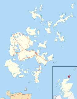
 Switha

