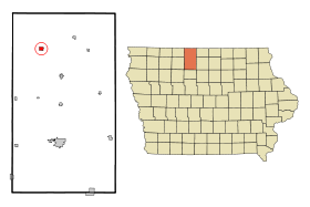
Swea City (Iowa)
Contenu soumis à la licence CC-BY-SA. Source : Article Swea City (Iowa) de Wikipédia en français (auteurs)
Regardez d'autres dictionnaires:
Swea City (Iowa) — Swea City Ciudad de los Estados Unidos … Wikipedia Español
Swea City, Iowa — Infobox Settlement official name = Swea City, Iowa settlement type = City nickname = motto = imagesize = image caption = image imagesize = image caption = image mapsize = 250x200px map caption = Location of Swea City, Iowa mapsize1 = map caption1 … Wikipedia
Swea City — Swea City, IA U.S. city in Iowa Population (2000): 642 Housing Units (2000): 330 Land area (2000): 0.736661 sq. miles (1.907944 sq. km) Water area (2000): 0.000000 sq. miles (0.000000 sq. km) Total area (2000): 0.736661 sq. miles (1.907944 sq.… … StarDict's U.S. Gazetteer Places
Swea City, IA — U.S. city in Iowa Population (2000): 642 Housing Units (2000): 330 Land area (2000): 0.736661 sq. miles (1.907944 sq. km) Water area (2000): 0.000000 sq. miles (0.000000 sq. km) Total area (2000): 0.736661 sq. miles (1.907944 sq. km) FIPS code:… … StarDict's U.S. Gazetteer Places
Iowa District West (LCMS) — The Iowa District West is one of the 35 districts of the Lutheran Church Missouri Synod (LCMS), and covers the western half of the state of Iowa including the state capital, Des Moines; the rest of the state forms the Iowa District East. The Iowa … Wikipedia
Iowa Highway 9 — Infobox road state=IA type=IA route=9 alternate name= length mi=296 length round=0 length ref=Iowahighwaysref|lowrg=1|hirng=9|num=9|access date=November 8, 2007] established= direction a=West starting terminus= junction= direction b=East ending… … Wikipedia
National Register of Historic Places listings in Iowa — … Wikipedia
List of high schools in Iowa — This is a list of high schools in the state of Iowa. You can also see a list of school districts in Iowa.Adair County*Nodaway Valley Community School District **Nodaway Valley High School, GreenfieldAdams County*Corning High School,… … Wikipedia
Algona (Iowa) — Pour les articles homonymes, voir Algona. 43° 04′ 13″ N 94° 13′ 47″ W / … Wikipédia en Français
Liste der Städte in Iowa — Die folgende Liste zeigt alle Kommunen und Siedlungen in Iowa. Sie enthält sowohl Citys (die einzige Form von selbstverwalteten Kommunen in Iowa) als auch Census designated places (CDP). Die obere Tabelle enthält die Siedlungen (ausnahmslos mit… … Deutsch Wikipedia
 États-Unis
 Iowa
Iowa


