Stockinish
- Stockinish
-
Stockinish est une île du Royaume-Uni située en Écosse.
Wikimedia Foundation.
2010.
Contenu soumis à la licence CC-BY-SA. Source : Article Stockinish de Wikipédia en français (auteurs)
Regardez d'autres dictionnaires:
Stockinish Island — Infobox Scottish island GridReference=NG136903 latitude=57.81 longitude= 6.82 celtic name= Eilean Stocainis norse name= meaning of name= area=49 ha area rank= 195= highest elevation= 44 m Population=0 population rank= main settlement= island… … Wikipedia
North Rona — Location … Wikipedia
North Lochs — North Lochs, (Scottish Gaelic: Ceann a Tuath nan Loch), an area in southeast Lewis, Outer Hebrides, Scotland, is named for the many lochans (small lochs) which dot the landscape. Because of its largely undulating and rocky terrain, it is sparsely … Wikipedia
The Minch — Map of the Hebrides, showing the Minch The Little Minch, view towards Loch na Madadh … Wikipedia
Dun Carloway — Coordinates: 58°16′10.35″N 6°47′38.47″W / 58.2695417°N 6.7940194°W / 58.2695417; 6.7940194 … Wikipedia
Carloway — Coordinates: 58°16′N 6°46′W / 58.27°N 6.77°W / 58.27; 6.77 … Wikipedia
Melbost — Scottish Gaelic: Mealabost Language Scottish Gaelic English Lieutenancy area Western Isles … Wikipedia
Church of St Clement, Rodel — Saint Clement s church photographed from the pathway leading up to the main entrance St Clement s Church (Scottish Gaelic: Tùr Chliamhainn, meaning Clement s Tower) is a fifteenth century church in Rodel, Harris, Scotland, built for the Chiefs of … Wikipedia
Callanish Stones — The stone circle at the centre of the Standing Stones of Callanish ( Callanish I ) … Wikipedia
Clisham — An Cliseam Elevation 799 m (2,621 ft) … Wikipedia
 Royaume-Uni
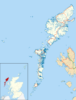
 Stockinish

