Stanthorpe
Contenu soumis à la licence CC-BY-SA. Source : Article Stanthorpe de Wikipédia en français (auteurs)
Regardez d'autres dictionnaires:
Stanthorpe — ▪ Queensland, Australia town, southeastern Queensland, eastern Australia, near the New South Wales border. Tin, discovered in 1872 in the locality, led to the development of the town, which was first called Stannum (from the Latin, meaning… … Universalium
Stanthorpe — Original name in latin Stanthorpe Name in other language SNH, Stanthorpe, Stehntkhorp, Стэнтхорп State code AU Continent/City Australia/Brisbane longitude 28.65721 latitude 151.93372 altitude 795 Population 4695 Date 2012 02 28 … Cities with a population over 1000 database
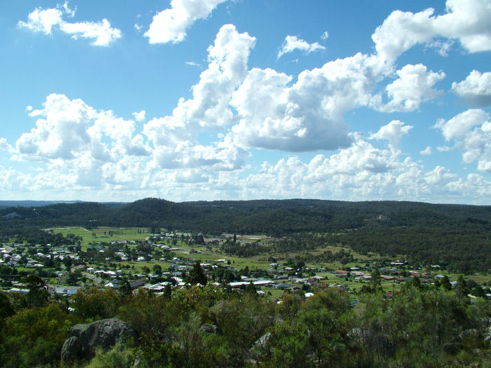
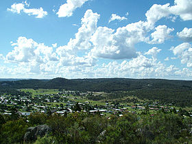
Stanthorpe, Queensland — Infobox Australian Place | type = town name = Stanthorpe state = qld caption = Stanthorpe township (north west aspect) taken from Mt Marlay lookout lga = Southern Downs Regional Council postcode = 4380 est = pop = 10,575 (est) elevation= 873… … Wikipedia
Stanthorpe — /ˈstænθɔp/ (say stanthawp) noun a town and shire in south eastern Qld, 45 km south of Warwick; important producer of stone fruits …
(10078) Stanthorpe — Stanthorpe (asteroide 10078) es un asteroide del cinturón principal, situado a 2,0960478 UA. Tiene una excentricidad de 0,1809918 y un periodo orbital de 1.495,42 días (4,1 años). Su velocidad orbital media es de 18,61813931 km/s y tiene una … Wikipedia Español
Comté de Stanthorpe — (Ancien) Comté de Stanthorpe Localisation de la LGA Données générales Pays Australie … Wikipédia en Français
Shire of Stanthorpe — Infobox Australian Place | type = lga name = Shire of Stanthorpe state = qld imagesize= 135 caption = Location within Queensland pop = 9,818 area = 2669 est = seat = Stanthorpe region = logosize = 100 url = http://www.stanthorpe.qld.gov.au/ near… … Wikipedia
10078 Stanthorpe — Infobox Planet minorplanet = yes width = 25em bgcolour = #FFFFC0 apsis = name = Stanthorpe symbol = caption = discovery = yes discovery ref = discoverer = T. Seki discovery site = Geisei discovered = October 30, 1989 designations = yes mp name =… … Wikipedia
New England Highway — New England Highway … Wikipedia
Granite Belt, Queensland — Infobox Australian Place | type = region name = Granite Belt state = Queensland caption = The town of Stanthorpe pop = area = est = url = stategov = Southern Downs fedgov = Maranoa lga = Southern Downs Regional Council lga2 = lga3 = lga4 = The… … Wikipedia
 Stanthorpe
 Australie
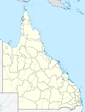
 Stanthorpe