Sierra High Route
- Sierra High Route
-
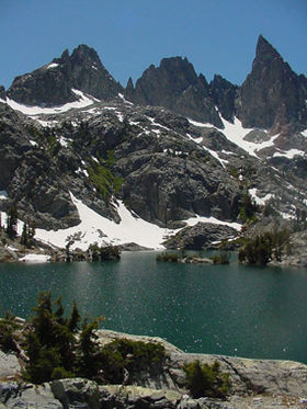
La Sierra High Route ou Roper Route est un sentier de grande randonnée long de 314 km, qui traverse la Sierra Nevada, de l'ouest des États-Unis.
Elle a été découverte par Steve Roper, un escaladeur, qu'il décrit dans son livre Sierra High Route: Traversing Timberline Country, paru en 1997.
Wikimedia Foundation.
2010.
Contenu soumis à la licence CC-BY-SA. Source : Article Sierra High Route de Wikipédia en français (auteurs)
Regardez d'autres dictionnaires:
Sierra High Route — The Sierra High Route (also called the Roper Route) is a cross country hiking route, convert|195|mi|km long, through the Sierra Nevada. It was scouted by Steve Roper and described by him in his book Sierra High Route: Traversing Timberline… … Wikipedia
Sierra Nevada (U.S.) — Geobox|Range name=Sierra Nevada image size=300 image caption=Little Lakes Valley: typical eastside terrain country=United States state=California| state1=Nevada parent= | border= length imperial=400 length orientation=North South highest=Mount… … Wikipedia
Sierra de Guadarrama — Sub Range Peaks of La Pedriza … Wikipedia
Sierra Leone — Sierra Leonean /lee oh nee euhn/. /lee oh nee, lee ohn / an independent republic in W Africa: member of the Commonwealth of Nations; formerly a British colony and protectorate. 4,891,546; 27,925 sq. mi. (72,326 sq. km). Cap.: Freetown. * * *… … Universalium
List of books about the Sierra Nevada (U.S.) — The following is a partial list of books about the Sierra Nevada of California, USA. Please see Sierra Nevada for more information. General travel * Yosemite The Southern Sierra Nevada: A Complete Guide, Including Sequoia Kings Canyon, Death… … Wikipedia
List of Sierra Nevada topics — This is a list of Sierra Nevada topics, about the Sierra Nevada of California, USA. Please see Sierra Nevada for alternative meanings. See also: List of books about the Sierra Nevada for further reading.Principal MountainsList of mountains over… … Wikipedia
Route of the Lincoln Highway — The Lincoln Highway followed the following route:New YorkThe very short Lincoln Highway section in New York went west from Times Square on 42nd Street to the Weehawken Ferry. It was realigned down Broadway from which it turned right and passed… … Wikipedia
High Sierra Trail — Infobox Hiking trail Name = High Sierra Trail Photo = High sierra trail.jpg Caption = Trail near Hamilton Lake Length = Convert|49|mi|km|0cite book last = Secor first = R. J. title = The High Sierra: Peaks, Passes, and Trails (2nd ed.) publisher … Wikipedia
Sierra Blanca — Infobox Mountain Name = Sierra Blanca Peak Photo = Sierra Blanca and electricity pole.jpg Caption = Elevation = convert|12005|ft|m|0This is the new NAVD88 elevation, superseding the old elevation of convert|11973|ft|m|0. See the peaklist… … Wikipedia
Sierra Nevada de Santa Marta — Infobox Mountain Name = Sierra Nevada de Santa Marta Photo = Sierra Nevada de Santa Marta desde el espacio.jpg Photo size = 250px Caption = Sierra Nevada de Santa Marta viewed from Space. Elevation = 5,700 metres Location = Northern region of… … Wikipedia

 États-Unis
