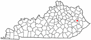
Salyersville
Contenu soumis à la licence CC-BY-SA. Source : Article Salyersville de Wikipédia en français (auteurs)
Regardez d'autres dictionnaires:
Salyersville — Salyersville, KY U.S. city in Kentucky Population (2000): 1604 Housing Units (2000): 710 Land area (2000): 2.115870 sq. miles (5.480077 sq. km) Water area (2000): 0.000000 sq. miles (0.000000 sq. km) Total area (2000): 2.115870 sq. miles… … StarDict's U.S. Gazetteer Places
Salyersville, KY — U.S. city in Kentucky Population (2000): 1604 Housing Units (2000): 710 Land area (2000): 2.115870 sq. miles (5.480077 sq. km) Water area (2000): 0.000000 sq. miles (0.000000 sq. km) Total area (2000): 2.115870 sq. miles (5.480077 sq. km) FIPS… … StarDict's U.S. Gazetteer Places
Salyersville — Original name in latin Salyersville Name in other language State code US Continent/City America/New York longitude 37.75259 latitude 83.06878 altitude 259 Population 1883 Date 2011 05 14 … Cities with a population over 1000 database
Salyersville — Sp Sáljersvilis Ap Salyersville L JAV Magofino apyg. c. (Kentukis) … Pasaulio vietovardžiai. Internetinė duomenų bazė
Salyersville, Kentucky — Infobox Settlement official name = Salyersville, Kentucky settlement type = City nickname = motto = imagesize = 250px image caption = Magoffin County Justice Center in downtown Salyersville image mapsize = 250px map caption = Location of… … Wikipedia
Salyersville National Bank — Infobox nrhp | name =Salyersville Bank nrhp type = nrhp caption = Salyersville Bank building. location= Salyersville, Kentucky lat degrees = 37 lat minutes = 45 lat seconds = 10 lat direction = N long degrees = 83 long minutes = 4 long seconds =… … Wikipedia
Battle of Salyersville — Infobox Military Conflict conflict=Battle of Salyersville (or Ivy Point Hill) partof=the American Civil War caption= date=April 13 14, 1864 place=Salyersville, Magoffin County, Kentucky casus= territory= result=Union victory… … Wikipedia
41463 — Salyersville, Ky (Miscellaneous » ZIP Codes) … Abbreviations dictionary
41465 — Salyersville, Ky (Miscellaneous » ZIP Codes) … Abbreviations dictionary
Magoffin County, Kentucky — Magoffin County justice center in Salyersville, Kentucky … Wikipedia
 États-Unis
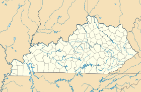
 Kentucky