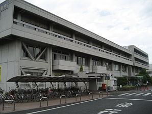
Sakado
- Sakado
-
Sakado (坂戸市, Sakado-shi?) est une ville (市, shi) de la préfecture de Saitama, au Japon. La ville a été fondée le 1er septembre 1976. La population de la ville est de 100 758 habitants pour une superficie de 40,97 km2 (2010).
Liens externes
Wikimedia Foundation.
2010.
Contenu soumis à la licence CC-BY-SA. Source : Article Sakado de Wikipédia en français (auteurs)
Regardez d'autres dictionnaires:
Sakado — shi 坂戸市 … Deutsch Wikipedia
Sakado — Original name in latin Sakado Name in other language Sakado, ban hu shi State code JP Continent/City Asia/Tokyo longitude 35.95694 latitude 139.38889 altitude 33 Population 96656 Date 2012 01 19 … Cities with a population over 1000 database
Sakado Station — is the name of multiple train stations in Japan.* Sakado Station (Saitama) (坂戸駅) in Saitama Prefecture * Sakado Station (Fukuoka) (酒殿駅) in Fukuoka Prefecture * Sakado Station (Ibaraki) (坂戸駅) in Ibaraki Prefecture (closed 2007) … Wikipedia
Sakado Station (Saitama) — infobox japan station namerom= Sakado name= 坂戸 imagesize= caption= Sakado Station south exit pref= Saitama city= Sakado ward= town= village= district= address= 1 1 Hinode chō jaloc= 坂戸市日の出町1 1 postal= 350 0225 open= 1916 close= oldname= Sakado… … Wikipedia
Sakado, Saitama — Japanese city Name = Sakado JapaneseName=坂戸市 Prefecture=Saitama Region=Kantō Area km2=40.97 Population=100,240 PopDate=2008 Density km2=2431 Coords= LatitudeDegrees = 35 LatitudeMinutes = 57 LatitudeSeconds = LongtitudeDegrees = 139… … Wikipedia
Sakado-shi — Admin ASC 2 Code Orig. name Sakado shi Country and Admin Code JP.34.1853207 JP … World countries Adminstrative division ASC I-II
Tojo-Hauptlinie — In diesem Artikel oder Abschnitt fehlen folgende wichtige Informationen: Es fehlen Streckenverlauf, Geschichte, Streckensicherung, Hoch und Kunstbauten Du kannst Wikipedia helfen, indem du sie recherchierst und einfügst … Deutsch Wikipedia
Tōbu-Tōjō-Hauptlinie — In diesem Artikel oder Abschnitt fehlen folgende wichtige Informationen: Es fehlen Streckenverlauf, Geschichte, Streckensicherung, Hoch und Kunstbauten Du kannst Wikipedia helfen, indem du sie recherchierst und einfügst … Deutsch Wikipedia
Tōbu Tōjō Line — In diesem Artikel oder Abschnitt fehlen folgende wichtige Informationen: Es fehlen Streckenverlauf, Geschichte, Streckensicherung, Hoch und Kunstbauten Du kannst Wikipedia helfen, indem du sie recherchierst und einfügst … Deutsch Wikipedia
Tōbu Ogose Line — Ogose Line 8000 series EMU at Sakado station, September 2006 Overview Type Commuter rail Locale … Wikipedia


