Royal Geographical Society Island
Contenu soumis à la licence CC-BY-SA. Source : Article Royal Geographical Society Island de Wikipédia en français (auteurs)
Regardez d'autres dictionnaires:
Royal Geographical Society Island — Infobox Islands name = Royal Geographical Society Island image caption = image size = locator map custom = native name = native name link = Inuktikut nickname = location = Northern Canada coordinates = archipelago = total islands = major islands … Wikipedia
Île de la Royal Geographical Society — Royal Geographical Society Island (en) Géographie Pays … Wikipédia en Français
List of Australian organisations with royal patronage — Organisations* 1st 15th Royal New South Wales Lancers * Australasian Institute of Mining and Metallurgy (incorporated by Royal Charter) * Australian Academy of the Humanities (incorporated by Royal Charter) * Australian Academy of Science… … Wikipedia
Christmas Island — This article is about the Australian territory in the Indian Ocean. For other uses, see Christmas Island (disambiguation). Territory of Christmas Island … Wikipedia
Gough Island — Diego Alvarez redirects here. For the Colombian football player, see Diego Álvarez. Gough and Inaccessible Islands * UNESCO World Heritage Site … Wikipedia
Jackson Island — This article is about the island in Franz Josef Land. For the Canadian island, see Jackson Island (Nunavut). Jackson Russian: Остров Джексона Location of Jackson Island in the Franz Josef Archipelago … Wikipedia
Hooker Island — Location of Hooker Island in the Franz Josef Archipelago Hooker Island (Russian: остров Гукера; Ostrov Gukera) is one of the most important islands of Franz Josef Land. It is located in the central area of the archipelago at … Wikipedia
The Geographical Pivot of History — Sir Halford Mackinder s Heartland theory concept showing the situation of the pivot area established in the Theory of the Heartland. The Geographical Pivot of History was an article submitted by Halford John Mackinder in 1904 to the … Wikipedia
List of Irish organisations with royal patronage — List of organisations in the Republic of Ireland with a royal charter is an incomplete list of organisations based in Ireland that have received a royal charter from an Irish, English or British monarch.: See also List of organisations with a… … Wikipedia
Northbrook Island — Location of Northbrook Island in the Franz Josef Archipelago A coastal view o … Wikipedia
 Canada
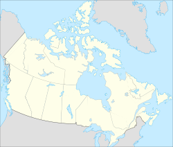 Île de la Royal Geographical Society
 Portail du Canada
 Portail du monde maritime