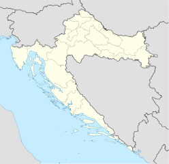
Ravna Gora (Primorje-Gorski Kotar)
- Ravna Gora (Primorje-Gorski Kotar)
-
Ravna Gora est un village et une municipalité située dans le comitat de Primorje-Gorski Kotar, en Croatie. Au recensement de 2001, la municipalité comptait 2 724 habitants, dont 97,83 % de Croates[1] et le village seul comptait 1 869 habitants[2].
Histoire
Cette section est vide,
insuffisamment détaillée ou incomplète.
Votre aide est la bienvenue !
Localités
La municipalité de Ravna Gora compte 6 localités :
- Kupjak
- Leskova Draga
- Ravna Gora
- Stara Sušica
- Stari Laz
- Šije
Notes et références
Voir aussi
Articles connexes
Liens externes
Wikimedia Foundation.
2010.
Contenu soumis à la licence CC-BY-SA. Source : Article Ravna Gora (Primorje-Gorski Kotar) de Wikipédia en français (auteurs)
Regardez d'autres dictionnaires:
Primorje-Gorski kotar — Gespanschaft Primorje Gorski kotar Primorsko goranska županija Datei:Primorsko goranska županija (grb).gif … Deutsch Wikipedia
Primorje-Gorski Kotar County — Croatian County name =Primorsko Goranska Županija image coat of arms =Grb PGZ.jpg image coat of arms size =100px Coat of arms image flag size =200px Flag capital =Rijeka area =3.582 km² population =305.505 date population =2001 density =85.3 /km² … Wikipedia
Comitat de Primorje-Gorski kotar — Primorsko goranska županija Localisation en Croatie Capitale Rijeka Superficie 3 582 km² Population 305� … Wikipédia en Français
Condado de Primorje-Gorski Kotar — Primorsko goranska županija Condado de Croacia … Wikipedia Español
Comitat de Primorje-Gorski Kotar — 45° 27′ 14″ N 14° 35′ 38″ E / 45.454, 14.594 … Wikipédia en Français
Gespanschaft Primorje-Gorski kotar — Primorsko goranska županija … Deutsch Wikipedia
Gorski kotar — (English: Mountain District ) is the mountainous region in Croatia between Karlovac and Rijeka. Together with Lika and the Ogulin Plaški valley it forms Mountainous Croatia. Because 63% of its surface is forested it is popularly called the green… … Wikipedia
Ravna gora — Cette page d’homonymie répertorie les différentes localités partageant un même nom. Ravna Gora ou Ravna gora est un toponyme qui peut désigner : en Croatie Ravna Gora, village et municipalités croates situés dans le comitat de… … Wikipédia en Français
Ravna Gora — Cette page d’homonymie répertorie les différentes localités partageant un même nom. Ravna Gora ou Ravna gora est un toponyme qui peut désigner : en Bulgarie (le nom étant écrit Равна гора, avec une seule majuscule) Ravna… … Wikipédia en Français
Gorski Kotar — Der See Lokvarsko jezero Blick vom Gipfel des Tuhobic zum Nationalpark Risnjak Der Gorski kotar ist eine Landschaft im Nordwesten Kroatiens … Deutsch Wikipedia
 Croatie
