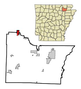
Ravenden
Contenu soumis à la licence CC-BY-SA. Source : Article Ravenden de Wikipédia en français (auteurs)
Regardez d'autres dictionnaires:
Ravenden — Ravenden, AR U.S. town in Arkansas Population (2000): 511 Housing Units (2000): 254 Land area (2000): 2.071598 sq. miles (5.365414 sq. km) Water area (2000): 0.013862 sq. miles (0.035902 sq. km) Total area (2000): 2.085460 sq. miles (5.401316 sq … StarDict's U.S. Gazetteer Places
Ravenden, AR — U.S. town in Arkansas Population (2000): 511 Housing Units (2000): 254 Land area (2000): 2.071598 sq. miles (5.365414 sq. km) Water area (2000): 0.013862 sq. miles (0.035902 sq. km) Total area (2000): 2.085460 sq. miles (5.401316 sq. km) FIPS… … StarDict's U.S. Gazetteer Places
Ravenden Springs — Ravenden Springs, AR U.S. town in Arkansas Population (2000): 137 Housing Units (2000): 83 Land area (2000): 1.147728 sq. miles (2.972603 sq. km) Water area (2000): 0.000000 sq. miles (0.000000 sq. km) Total area (2000): 1.147728 sq. miles… … StarDict's U.S. Gazetteer Places
Ravenden Springs, AR — U.S. town in Arkansas Population (2000): 137 Housing Units (2000): 83 Land area (2000): 1.147728 sq. miles (2.972603 sq. km) Water area (2000): 0.000000 sq. miles (0.000000 sq. km) Total area (2000): 1.147728 sq. miles (2.972603 sq. km) FIPS code … StarDict's U.S. Gazetteer Places
Ravenden, Arkansas — Infobox Settlement official name = Ravenden, Arkansas settlement type = Town imagesize = image caption = image imagesize = image caption = image mapsize = 250px map caption = Location in Lawrence County and the state of Arkansas mapsize1 = map… … Wikipedia
Ravenden Springs, Arkansas — Infobox Settlement official name = Ravenden Springs, Arkansas settlement type = Town imagesize = image caption = image imagesize = image caption = image mapsize = 250px map caption = Location in Randolph County and the state of Arkansas mapsize1 … Wikipedia
72459 — Ravenden, Ar (Miscellaneous » ZIP Codes) … Abbreviations dictionary
72460 — Ravenden Springs, Ar (Miscellaneous » ZIP Codes) … Abbreviations dictionary
National Register of Historic Places listings in Randolph County, Arkansas — Location of Randolph County in Arkansas This is a list of the National Register of Historic Places listings in Randolph County, Arkansas. This is intended to be a complete list of the properties and districts on the National Register of Historic… … Wikipedia
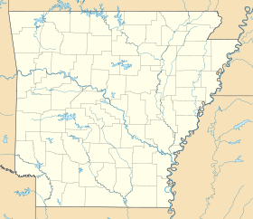
Arkansas — This article is about the U.S. state of Arkansas. For the river, see Arkansas River. For other uses, see Arkansas (disambiguation). State of Arkansas … Wikipedia
 États-Unis
 Arkansas