Rabča
- Rabča
-
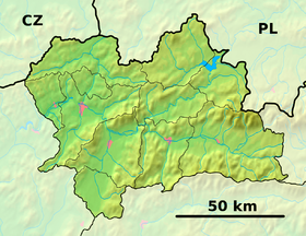
Rabča est un village de Slovaquie situé dans la région de Žilina.
Histoire
Première mention écrite du village en 1564.
Notes et références
Catégories :
- Village de Slovaquie
- Village et ville du district de Námestovo
Wikimedia Foundation.
2010.
Contenu soumis à la licence CC-BY-SA. Source : Article Rabča de Wikipédia en français (auteurs)
Regardez d'autres dictionnaires:
Rabča — Wappen Karte … Deutsch Wikipedia
Rabča — is a large village and municipality in Námestovo District in the Žilina Region of northern Slovakia.HistoryIn historical records the village was first mentioned in 1564.GeographyThe municipality lies at an altitude of 661 metres and covers an… … Wikipedia
Rabca — Sp Rabcà Ap Rábca L u. Vengrijoje … Pasaulio vietovardžiai. Internetinė duomenų bazė
Rábca — Sp Rabcà Ap Rábca L u. Vengrijoje … Pasaulio vietovardžiai. Internetinė duomenų bazė
Oravská Polhora — Coordinates: 49°31′N 19°27′E / 49.517°N 19.45°E / 49.517; 19.45 … Wikipedia
District de Námestovo — Námestovo Informations Pays … Wikipédia en Français
Geography of Hungary — Satellite image showing the seven main geographical regions of Hungary (in parenthesis: major region): 1., Great Alföld (Great Alföld) 2., North Hungarian Mountains (North Hungarian Mountains) 3., Transdanubian Mountains (Transdanubia) 4.,… … Wikipedia
Győr — Infobox Settlement image caption = Széchenyi Square image shield = WĘG Győr COA.jpg subdivision type = Country subdivision name = HUN timezone=CET utc offset=+1 timezone DST=CEST utc offset DST=+2 pushpin pushpin label position = pushpin map… … Wikipedia
Little Hungarian Plain — Landscape in Györ Moson Sopron Location Eastern Austria, Western Hungary, South western Slovakia Territory 8,000 km² … Wikipedia
Žilina Region — Geobox | Region name = Žilina other name = category = Region image caption = symbol = CoA Žilina Region Slovakia.png symbol type = Coat of arms etymology = official name = motto = nickname = country = Slovakia country state = region = district =… … Wikipedia
 Slovaquie


