Palakkad
- Palakkad
-
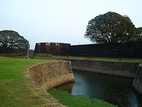
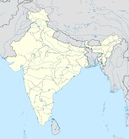
Palakkad (malayâlam : പാലക്കാട് - tamoul : பாலக்காடு) est une ville de l'État du Kerala en Inde, chef-lieu du district homonyme.
Géographie
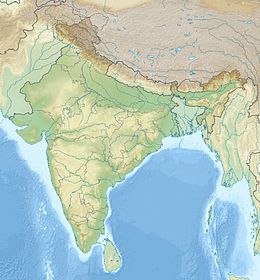
Palakkad se trouve près de la brèche de Palghat, dépression de terrain naturelle au travers de la chaîne des ghâts occidentaux parallèles à la côte ouest de l'Inde. Grâce à cette dépression, à ce col, il est possible de passer du Kerala aux plaines de l'État du Tamil Nadu, situé à l'est.
Les populations de Palakkad parlent le malayâlam ; dans les zones proches du Tamil Nadu, les gens parlent cependant fréquemment tamoul. La ville de Coimbatore au Tamil Nadu n'est distante de Palakkad que d'environ 50 km.
Économie
Cette section est vide,
insuffisamment détaillée ou incomplète.
Votre aide est la bienvenue !
Histoire
Cette section est vide,
insuffisamment détaillée ou incomplète.
Votre aide est la bienvenue !
Lieux et monuments
Cette section est vide,
insuffisamment détaillée ou incomplète.
Votre aide est la bienvenue !
Voir aussi
Lien externe
Wikimedia Foundation.
2010.
Contenu soumis à la licence CC-BY-SA. Source : Article Palakkad de Wikipédia en français (auteurs)
Regardez d'autres dictionnaires:
Palakkad — Palakkad … Deutsch Wikipedia
Palakkad — Infobox Indian Jurisdiction native name=Palakkad latd = 10.77|longd=76.65 state name=Kerala district=Palakkad leader title=Chairman leader name= Position Empty altitude=84 population as of = 2001 | population total = 130,736 | population density … Wikipedia
Palakkad — Original name in latin Palakkad Name in other language Palakkad, Palghat, Plght, pa la ke ka de, palakkad, palakkada, palakkara, palakkat, palakkatu, Палаккад State code IN Continent/City Asia/Kolkata longitude 10.7744 latitude 76.65625 altitude… … Cities with a population over 1000 database
Palakkad — ▪ India formerly Palghat city, central Kerala state, southwestern India. The city lies on the Ponnani River in the Palghat Gap, a break in the Western Ghats range. Its location has always given the town strategic and commercial importance … Universalium
Palakkad Iyers — also known as Kerala Iyers are Brahmin who have migrated to Palakkad from Tanjore district in the State of Tamil Nadu a few centuries ago. They are known as Palakkad Iyers because most of them settled down in the Palakkad district of Kerala which … Wikipedia
Palakkad Fort — ( Tipu s Fort ) is an old granite fort situated in the heart of Palakkad town (Palghaut) of Kerala state, southern India. It was built by Haider Ali in 1766 and remains one of the best preserved forts in Kerala.HistoryThe Palakkad Fort is said to … Wikipedia
Palakkad Heritage — (Pudunagaram,Индия) Категория отеля: Адрес: Karuvannthura ,Byepass road,Koduvayoo … Каталог отелей
Palakkad district — Infobox Indian Jurisdiction native name=Palakkad type= district hq=Palakkad latd = 10.775 longd= 76.651 state name=Kerala abbreviation=IN KL PKD collector=K. AjayaKumar area=4,480 area magnitude=9 |population total = 2617482 population year= 2004 … Wikipedia
Palakkad (Distrikt) — Distrikt Palakkad Bundesstaat: Kerala Verwaltungssitz: Palakkad Fläche … Deutsch Wikipedia
Palakkad Gap — Infobox Mountain Pass Name = Palakkad Gap Photo = Caption = Elevation = 300 m Location = IND Range = Western Ghats Coordinates = Topographic Transversed by =Palakkad Gap is a 32 42 kilometer wide low mountain pass in the Western Ghats, near… … Wikipedia
 Inde
Inde


