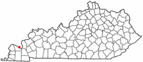
Paducah (Kentucky)
Contenu soumis à la licence CC-BY-SA. Source : Article Paducah (Kentucky) de Wikipédia en français (auteurs)
Regardez d'autres dictionnaires:
Paducah, Kentucky — City of Paducah City Irvin Cobb Hotel … Wikipedia
Paducah (Kentucky) — Paducah Lage in Kentucky Basisdaten Gründung: 1821 Staat … Deutsch Wikipedia
List of mayors of Paducah, Kentucky — Paducah, Kentucky formed from a mixed settlement of Native Americans and White Settlers along the confluence of the Tennessee River and Ohio River. The town was incorporated in 1830 and chartered as a city in 1856. The city is governed by an… … Wikipedia
National Weather Service Paducah, Kentucky — National Weather Service Paducah is a weather forecast office responsible for monitoring weather conditions for 58 counties in the states of Kentucky, Illinois, Indiana and Missouri.[1] The Paducah office is relatively new compared to others,… … Wikipedia
Temple Israel (Paducah, Kentucky) — is a Reform synagogue in Paducah, Kentucky.HistoryThe community was founded in 1864 as the Paducha Chevra Yeshrun Burial Society, the synagogue was chartered in 1871 and in 1873 became a charter member of the Union of American Hebrew… … Wikipedia
Masonic Temple (Paducah, Kentucky) — Masonic Temple U.S. National Register of Historic Places … Wikipedia
St. Mary High School (Paducah, Kentucky) — Infobox School name = St. Mary High School imagesize = motto = The Pursuit of Excellence Through Christ! motto translation = streetaddress = 1243 Elmdale Road city = Paducah state = KY zipcode = 42003 coordinates = url =… … Wikipedia
KENTUCKY — KENTUCKY, state in the south central United States. A receipt with a Yiddish notation surviving from 1781 reveals that the firm of Cohen and Isaacs in Richmond, Virginia, paid Daniel Boone for surveying land on its behalf in Kentucky, and other… … Encyclopedia of Judaism
Kentucky Dam — is a dam on the Tennessee River on the dividing line between Livingston County and Marshall County in the U.S. state of Kentucky. It impounds Kentucky Lake, which is 184 miles (296 km) long, and is the largest artificial lake in the eastern… … Wikipedia
Paducah Public Schools — is a school district located in Paducah, Kentucky. The district serves most, but not all, of the city of Paducah; significant areas within the city limits lie in the surrounding McCracken County school district.The district, founded in 1864,… … Wikipedia
 Pour les articles homonymes, voir Paducah.
 États-Unis
 Kentucky