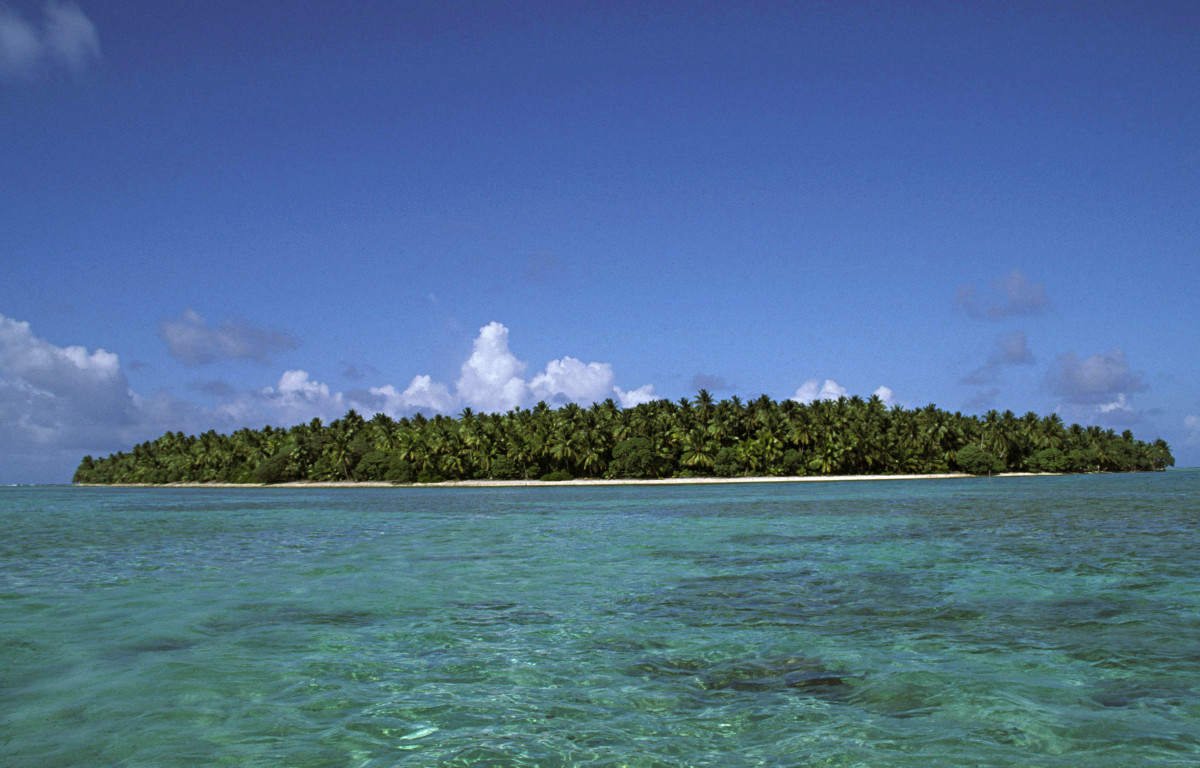
Oroluk

Oroluk
Oroluk
Vue d'Oroluk depuis l'océan Pacifique.
Géographie
Pays Drapeau des États fédérés de Micronésie Micronésie
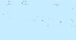
Archipel îles Carolines
Localisation Océan Pacifique
Coordonnées 7° 37′ 15″ N 155° 09′ 32″ E / 7.620952, 155.1588827° 37′ 15″ N 155° 09′ 32″ E / 7.620952, 155.158882
Superficie 0,13 km2
Point culminant non nommé (18 m)
Géologie Île corallienne
Administration
Drapeau des États fédérés de Micronésie Micronésie
État Pohnpei
Démographie
Population 10 hab.
Densité 76,92 hab./km2
Autres informations
Fuseau horaire UTC+11

Géolocalisation sur la carte : Micronésie

(Voir situation sur carte : Micronésie)
Oroluk
Oroluk
Îles des États fédérés de Micronésie

Oroluk est un atoll de Micronésie situé dans le district des autres îles de Pohnpei, dans l'État de Pohnpei. D'une superficie de 0,13 km2, il compte dix habitants (2008).

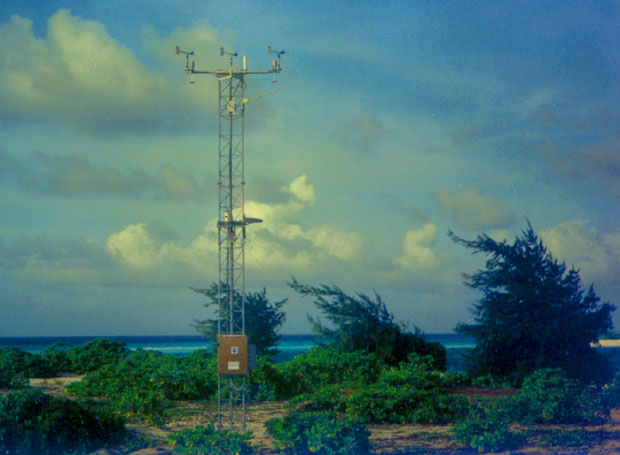
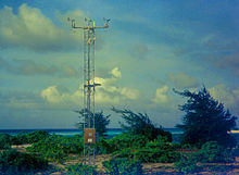
Vue de la station météorologique d'Oroluk.

Wikimedia Foundation. 2010.

Contenu soumis à la licence CC-BY-SA. Source : Article Oroluk de Wikipédia en français (auteurs)

Игры ⚽ Нужна курсовая?

Regardez d'autres dictionnaires:

  • Oroluk — ist: Oroluk (Atoll), ein Atoll in Mikronesien Oroluk (Insel), einzige Insel des Atolls Oroluk Diese Seite ist eine Begriffsklärung zur Unterscheidung mehrerer mit demselben Wort bezeichneter Begriffe …   Deutsch Wikipedia

  • Oroluk — Map of Pohnpei State Oroluk is one of the administrative divisions of Pohnpei State, Federated States of Micronesia.[1] Description Oroluk municipality includes Oroluk Atoll and Minto Reef. This municipality is almost uninhabite …   Wikipedia

  • Oroluk-Atoll — Gewässer Pazifischer Ozean Archipel Anzahl der Inseln ca. 25 …   Deutsch Wikipedia

  • Oroluk Atoll — Gewässer Pazifischer Ozean Archipel Anzahl der Inseln ca. 25 …   Deutsch Wikipedia

  • Oroluk (Insel) — Oroluk Oroluk Island Gewässer Pazifischer Ozean Inselgruppe …   Deutsch Wikipedia

  • Oroluk (Atoll) — Vorlage:Infobox Insel/Wartung/Höhe fehlt Oroluk Atoll Karte des Oroluk Atolls Gewässer Pazifischer Ozean Archipel …   Deutsch Wikipedia

  • Oroluk Atoll — Map of Pohnpei State (with Oroluk Atoll) Map of Oroluk Atoll Oroluk Atoll is an …   Wikipedia

  • Oroluk Island — Map of Orolu Atoll with Oroluk island Oroluk Island is one of the islets of Oroluk Atoll, part of the State of Pohnpei (Federated States of Micronesia). Oroluk is currently uninhabited and is 0.13 km² in size. It was formerly inhabited. The… …   Wikipedia

  • Oroluk Municipality — Admin ASC 2 Code Orig. name Oroluk Municipality Country and Admin Code FM.02.OR FM …   World countries Adminstrative division ASC I-II

  • Isla Oroluk — Vista de la isla Localización País …   Wikipedia Español

Share the article and excerpts

Direct link
Do a right-click on the link above
and select “Copy Link”