Muldoanich
Contenu soumis à la licence CC-BY-SA. Source : Article Muldoanich de Wikipédia en français (auteurs)
Regardez d'autres dictionnaires:
Muldoanich — Location … Wikipedia
Muldoanich — es una de las diez islas que componen las Islas de Barra, en el archipiélago de las Hébridas Exteriores, en Escocia. La isla ocupa una superficie de 78 ha. Su punto más alto se encuentra a 153 msnm. El nombre de Muldoanich es un anglicismo de su… … Wikipedia Español
Mingulay — Location OS grid reference NL560830 … Wikipedia
Barra Isles — The Barra Isles, also known as the Bishop s Isles as they were historically owned by the church, are a small archipelago of islands in the Outer Hebrides of Scotland. They lie south of the island of Barra, for which they are named. The group… … Wikipedia
Sandray — Infobox Scottish island latitude=56.89 longitude= 7.52 GridReference=NL651914 celtic name= Sanndraigh norse name= meaning of name= Sand island (Norse) area=385 ha (1.5 sq. miles) area rank=77 highest elevation= 207 m Population=uninhabited since… … Wikipedia
Kisimul Castle — Part of Barra, Western Isles Castlebay, Scotland … Wikipedia
Northbay — For similarly named places, see North Bay (disambiguation). Coordinates: 57°00′N 7°25′W / 57.00°N 7.42°W / 57.00; 7.42 … Wikipedia
List of places in the Western Isles — Please note, that Western Isles can traditionally refer to the Hebrides, but here refers to the Outer Hebrides alone This List of places in the Western Isles is a list of links for any town, village, hamlet, island, port, river, harbour, historic … Wikipedia
Liste britischer Inseln — Lage der Britischen Inseln Diese Liste führt die wichtigsten der etwa 600 Inseln der Britischen Inseln auf. Politisch sind diese Inseln Teil des Vereinigten Königreiches, der Republik Irland und der Isle of Man, die als Kronbesitz kein… … Deutsch Wikipedia
Liste der Britischen Inseln — Lage der Britischen Inseln Diese Liste führt die wichtigsten der etwa 600 Inseln der Britischen Inseln auf. Politisch sind diese Inseln Teil des Vereinigten Königreichs, der Republik Irland und der Isle of Man, die als Kronbesitz kein Bestandteil … Deutsch Wikipedia
 Royaume-Uni
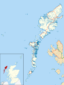
 Muldoanich

