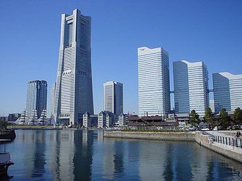
Minato mirai 21
- Minato mirai 21
-
Minato Mirai 21
Le Nord ou le Minato Mirai 21 est une zone portuaire de la ville de japonaise de Yokohama à l'architecture audacieuse complètement réhabilitée.
Ce quartier, situé au nord de la gare Sakuragi-cho, abrite notamment un musée de la marine, le musée d'art moderne et de la photographie (Yokohama Museum of Art) réalisé par l'architecte japonais Kenzō Tange, le parc d'attraction Cosmo World et le Landmark Tower qui est, avec ses 70 étages, l'un des immeubles les plus haut d'Asie.
 Portail de l’architecture et de l’urbanisme
 Portail du Japon
Catégories : Géographie du Japon | Architecture japonaise
Wikimedia Foundation.
2010.
Contenu soumis à la licence CC-BY-SA. Source : Article Minato mirai 21 de Wikipédia en français (auteurs)
Regardez d'autres dictionnaires:
Minato Mirai 21 — at dusk Cosmo Clock 21 Ferris wheel … Wikipedia
Minato Mirai 21 — Minato Mirai 21. Minato Mirai 21 por la noche … Wikipedia Español
Minato Mirai 21 — Minato Mirai 21, überragt vom Landmark Tower. Minato Mirai 21 (jap. みなとみらい21, dt. „Hafen Zukunft 21“, abgekürzt MM21) ist ein großes Stadtentwicklungsprojekt in Yokohama. Es wurde auf einem 110 Hektar großen Gelände aus ehemaligen Docks und… … Deutsch Wikipedia
Minato Mirai 21 — Pour les articles homonymes, voir Minato. Le quartier Minato Mirai 21 vu de la Baie de Tōkyō. Le Minato Mirai 21 est une zone portuaire de la ville de … Wikipédia en Français
Minato Mirai Station — infobox japan station namerom= Minato Mirai name= みなとみらい imagesize= caption= Entrance No.5 pref= Kanagawa city= Yokohama ward= Nishi town= village= district= address= jaloc= postal= open= 2004 close= oldname= presentname= station number= operator … Wikipedia
Minato — Cette page d’homonymie répertorie les différents sujets et articles partageant un même nom. « Minato » (港, « Minato »? … Wikipédia en Français
MM21 — Minato Mirai 21, überragt vom Landmark Tower. Minato Mirai 21 (jap. みなとみらい21, dt. „Hafen Zukunft 21“, abgekürzt MM21) ist ein großes Stadtentwicklungsprojekt in Yokohama. Es wurde auf einem 110 Hektar großen Gelände aus ehemaligen Docks und… … Deutsch Wikipedia
Yokohama — Infobox City Japan Name= Yokohama JapaneseName= 横浜市 Map Region= Kantō Prefecture= Kanagawa District= Area km2= 437.35 PopDate= June 2008 Population= 3,645,507 Density km2= 8335 Coords= LatitudeDegrees= 35 LatitudeMinutes= 27 LatitudeSeconds=… … Wikipedia
Kannai — nihongo|Kannai|関内 is a region in Naka Ward, Yokohama, Japan, bounded by the Ōoka River, JR Negishi Line, Nakamura River, and the Ocean. Kannai is not an official name of the area, but it has been in use for over a century.Within it are the old… … Wikipedia
Ferris wheel — For other uses, see Ferris wheel (disambiguation). A Ferris wheel (also known as an observation wheel or big wheel) is a nonbuilding structure consisting of a rotating upright wheel with passenger cars (sometimes referred to as gondolas or… … Wikipedia

