Loch Linnhe
- Loch Linnhe
-

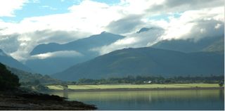
Le Loch Linnhe vu depuis Fort William
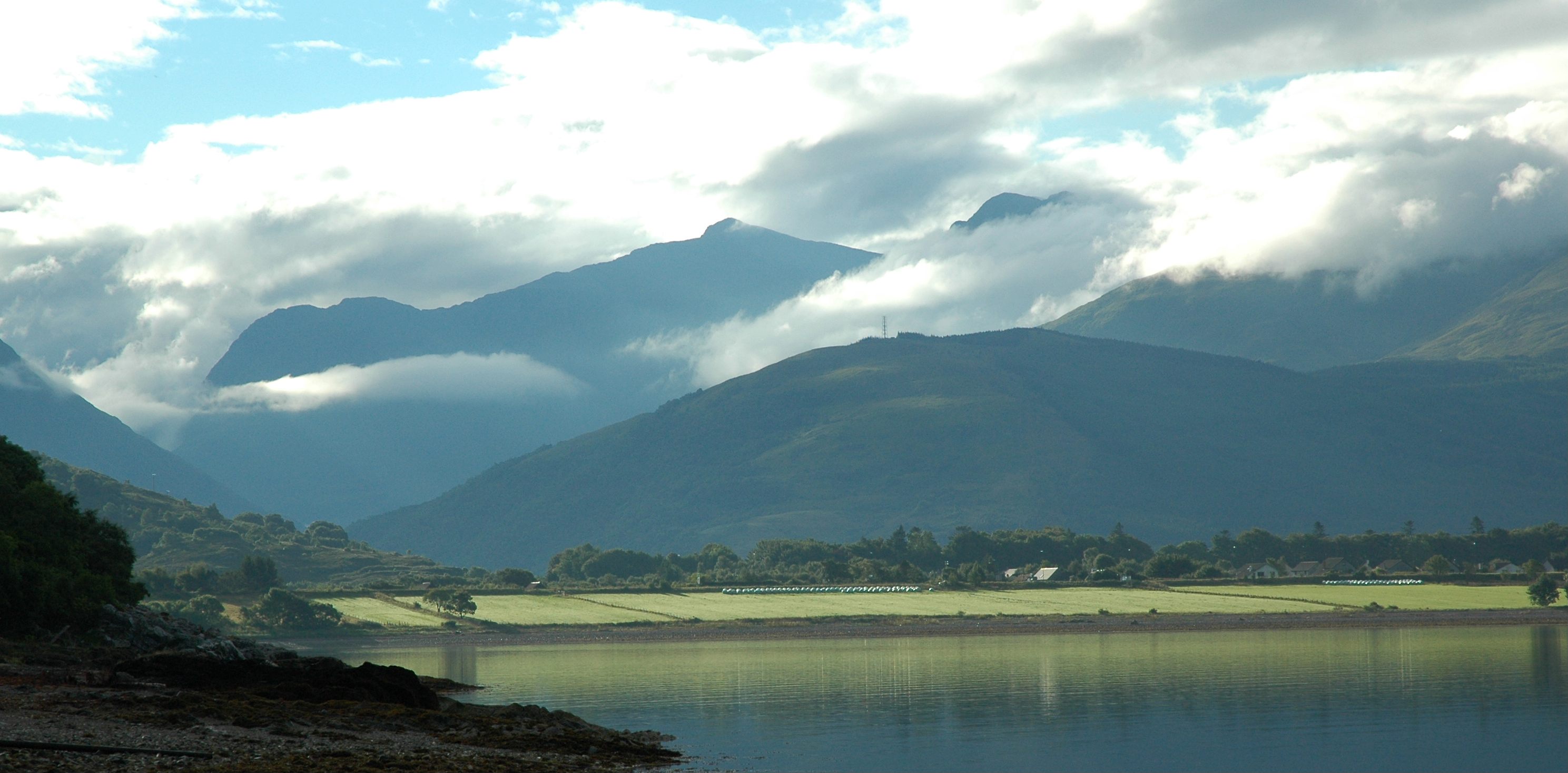
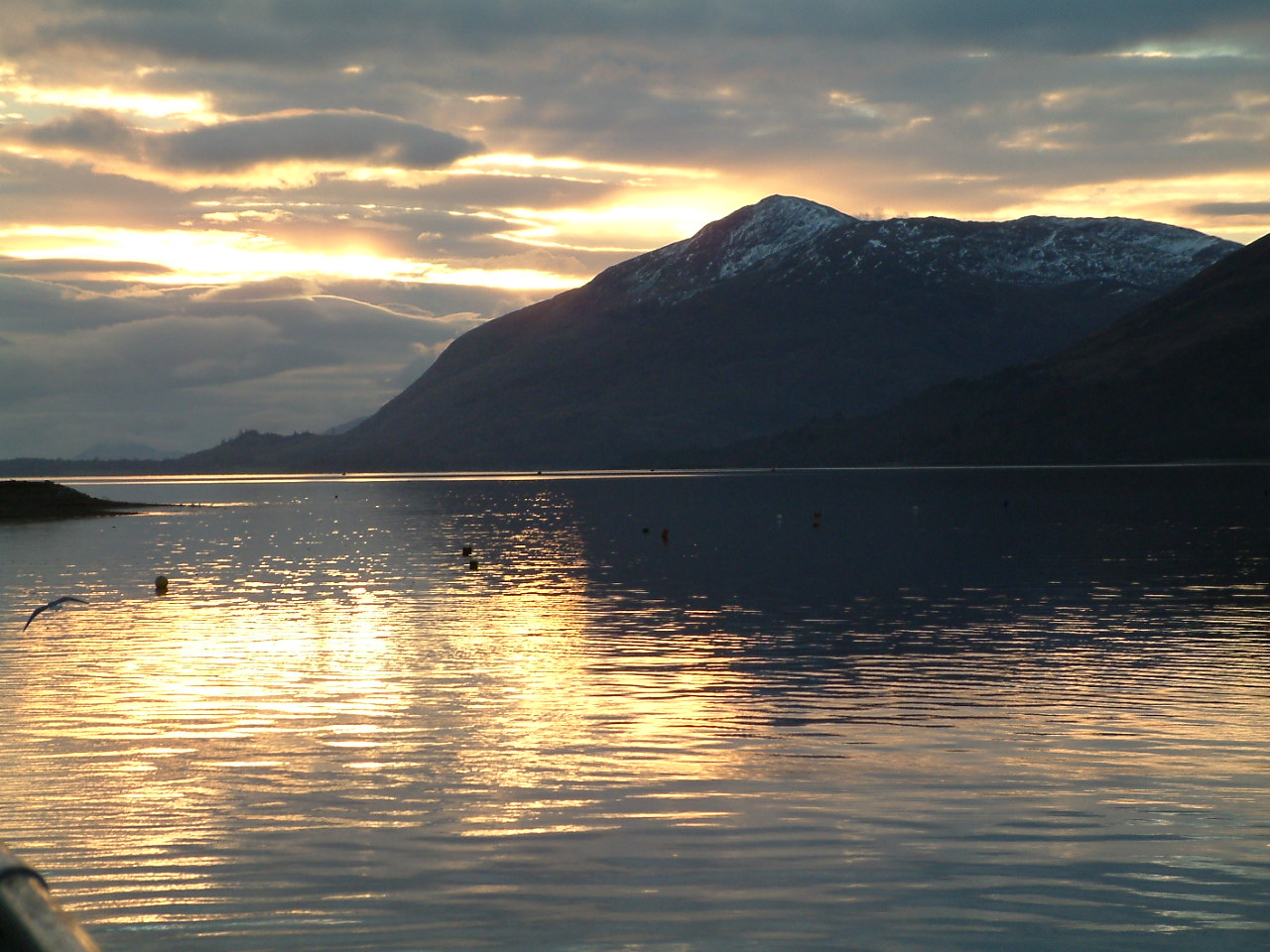
Le Loch Linnhe (ou An Linne Dhubh en gaélique en amont de Corran et An Linne Sheileach en aval) est un loch marin sur la côte ouest de l'Écosse.
Le Loch Linnhe s'étend sur 15 km pour une largeur moyenne de 2 km. Il débouche dans l'estuaire de Lorne à son extrémité sud-ouest. La ville de Fort William est située à l'extrémité nord-est du loch, sur l'embouchure de la rivière Lochy. Le Loch Eil alimente le Loch Linnhe à l'extrême nord de celui-ci.
Pendant les mois d'été, le Loch Linnhe est aligné avec le soleil couchant, devenant ainsi un lieu très prisé des photographes.
Voir aussi
Liens internes
Sources
Wikimedia Foundation.
2010.
Contenu soumis à la licence CC-BY-SA. Source : Article Loch Linnhe de Wikipédia en français (auteurs)
Regardez d'autres dictionnaires:
Loch Linnhe — 56.701388888889 5.2619444444445 Koordinaten … Deutsch Wikipedia
Loch Linnhe — Loch Linnhe. Loch Linnhe (conocido en gaélico escocés como An Linne Dhubh corriente arriba de Corran y como An Linne Sheileach corriente abajo de Corran) es un loch marítimo, es decir, un estuario o fiordo y no un lago, en la costa occidental de… … Wikipedia Español
Loch Linnhe — (known in Gaelic as An Linne Dhubh upstream of Corran and as An Linne Sheileach downstream of Corran) is a sea loch on the west coast of Scotland.Loch Linnhe extends 15 kilometres and is an average of 2 kilometres wide. It opens onto the Firth of … Wikipedia
Loch Linnhe — Sp Linio ẽžeras Ap Loch Linnhe angliškai, geliškai (škotiškai) Sp Lòch Linis Ap Loch Linnhe angliškai, geliškai (škotiškai) L D. Britanijoje (Škotijoje) … Pasaulio vietovardžiai. Internetinė duomenų bazė
Loch Linnhe — noun an inlet of the Atlantic Ocean on the western coast of Scotland • Instance Hypernyms: ↑loch • Part Holonyms: ↑Scotland … Useful english dictionary
Shuna, Loch Linnhe — Infobox Scottish island | latitude=56.59 longitude= 5.395 GridReference=NM916490 celtic name= norse name= meaning of name= area=155 ha area rank= 122 highest elevation=Tom an t Seallaidh 71 m Population=0 population rank= main settlement= island… … Wikipedia
Loch Lochy — Geographische Lage Highland, Schottland Zuflüsse Kaledonisch … Deutsch Wikipedia
Loch Creran — Vue depuis Appin vers Sgurr Mor, Benderloch Administration Pays … Wikipédia en Français
Loch Eil — Vue du sud est depuis la rive situé à l extrémité ouest du loch Eil. Administration Pays … Wikipédia en Français
Loch Eil — (Scottish Gaelic, Loch Iall ) is a sea loch in Lochaber, Scotland that opens into Loch Linnhe near the town of Fort William.Loch Eil Outward Bound railway station and Locheilside railway station are both situated on the northern shore of the loch … Wikipedia
 Le Loch Linnhe