Llanelwedd
Contenu soumis à la licence CC-BY-SA. Source : Article Llanelwedd de Wikipédia en français (auteurs)
Regardez d'autres dictionnaires:
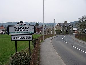
Llanelwedd — infobox UK place country = Wales constituency welsh assembly= map type= official name= Llanelwedd population= 787 unitary wales= Powys lieutenancy wales= Powys constituency westminster= Brecon Radnorshire post town= BUILTH WELLS postcode district … Wikipedia
Machynlleth — Coordinates: 52°35′27″N 3°50′56″W / 52.59087°N 3.84887°W / 52.59087; 3.84887 … Wikipedia
New Radnor — For the former parliamentary constituency, see New Radnor (UK Parliament constituency). Coordinates: 52°14′N 3°10′W / 52.24°N 3.16°W / 52.24; 3.16 … Wikipedia
Montgomery, Powys — Coordinates: 52°33′46″N 3°08′57″W / 52.5628°N 3.1493°W / 52.5628; 3.1493 … Wikipedia
Crickhowell — Coordinates: 51°51′35″N 3°08′14″W / 51.8597°N 3.1372°W / 51.8597; 3.1372 … Wikipedia
Criggion — is a village in Powys, Wales. Criggion radio station was located nearby. A branch of the now defunct Shropshire and Montgomeryshire Railway stopped at Criggion. External links grid reference SJ293149 Bausley with Criggion Community Council Home… … Wikipedia
Meifod — Coordinates: 52°43′N 3°15′W / 52.71°N 3.25°W / 52.71; 3.25 … Wikipedia
Cwmtwrch — is a village in the Swansea Valley, Wales, some 15 miles north of Swansea. Contents 1 History and origins 2 Amenities 3 Sport 4 Photos of … Wikipedia
Church Stoke — Churchstoke or Church Stoke (Welsh: Yr Ystog) is a large village in Powys, but adjacent to the English Welsh border, on the junction of the A489 and A490 roads. It is overlooked by Roundton Hill. The nearest town is Montgomery. An outline map of… … Wikipedia
Cilmeri — The memorial to Llywelyn ap Gruffudd near Cilmeri Cilmeri (sometimes given the anglicised spelling Cilmery) is a village in Powys, mid Wales two and a half miles west of Builth Wells on the A483 to Llandovery. The village is served by Cilmeri… … Wikipedia
 Llanelwedd
