Ivongo
- Ivongo
-
22° 18′ S 47° 12′ E / -22.30, 47.2
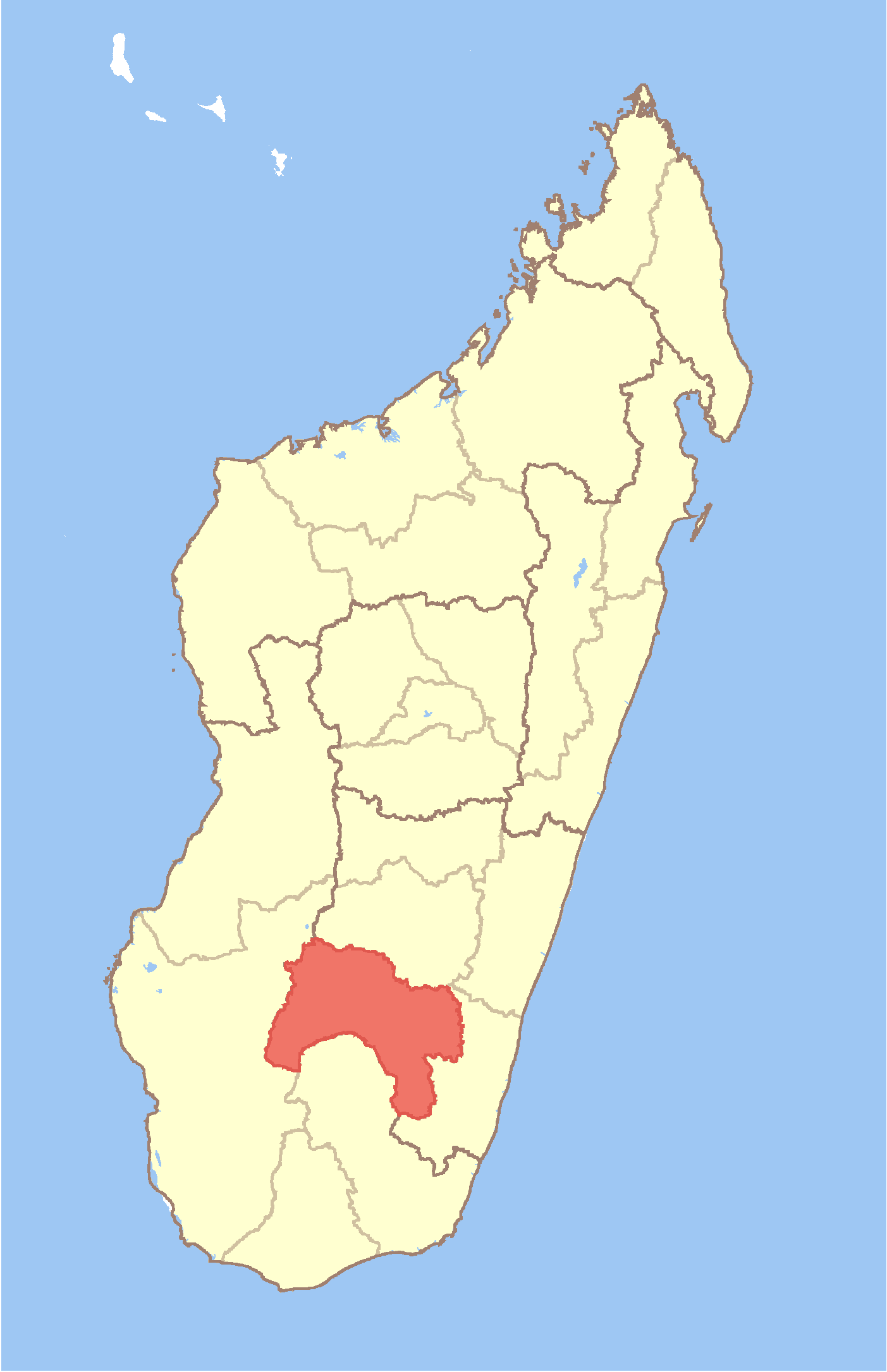
Ivongo est une ville et une commune rurale (Kaominina) située dans la région d'Ihorombe (province de Fianarantsoa), dans le sud de Madagascar.
Géographie
Cette section est vide, insuffisamment détaillée ou incomplète.
Votre aide est la bienvenue !
Démographie
La population est estimée à 5 000[1].
Économie
56% de la population travaille dans le secteur agricole. Les cultures sont le riz, le maïs, la canne à sucre, les bananes et du manioc.
Notes et références de l'article
- ↑ Site Ilo, Université Cornell (2002). 13 février 2008
Voir aussi
Articles connexes
Liens et documents externes
Wikimedia Foundation.
2010.
Contenu soumis à la licence CC-BY-SA. Source : Article Ivongo de Wikipédia en français (auteurs)
Regardez d'autres dictionnaires:
Ivongo — Ivongo, Provinz im Osten der Insel Madagascar; gebirgig, aber fruchtbar, holzreich, mit viel Reis u. großen Viehheerden, bei Iba Bathi werden große Bergkrystalle gefunden; zum Theil gehört die große Antongilbai hierher, an der ehemals die… … Pierer's Universal-Lexikon
Ivongo — Infobox Settlement official name = Ivongo other name = native name = nickname = settlement type = motto = imagesize = image caption = flag size = image seal size = image shield = shield size = image blank emblem = blank emblem type = blank emblem … Wikipedia
Soanierana Ivongo — 16° 55′ 00″ S 49° 35′ 00″ E / 16.916667, 49.583333 … Wikipédia en Français
District de Soanierana Ivongo — Soanierana Ivongo Région Analanjirofo Chef lieu Soanierana Ivongo Nombre de kaominina 8 Madagascar … Wikipédia en Français
Soanierana Ivongo — Infobox Settlement official name = Soanierana Ivongo other name = native name = nickname = settlement type = motto = imagesize = image caption = flag size = image seal size = image shield = shield size = image blank emblem = blank emblem type =… … Wikipedia
Ambodiampana (Soanierana Ivongo) — 16° 49′ 00″ S 49° 34′ 00″ E / 16.816667, 49.566667 … Wikipédia en Français
Antanifotsy (Soanierana Ivongo) — 16° 52′ 00″ S 49° 38′ 00″ E / 16.866667, 49.633333 … Wikipédia en Français
Antenina (Soanierana Ivongo) — 16° 34′ 00″ S 49° 15′ 00″ E / 16.566667, 49.25 … Wikipédia en Français
Ambodiampana, Soanierana Ivongo — Infobox Settlement official name = Ambodiampana other name = native name = nickname = settlement type = motto = imagesize = image caption = flag size = image seal size = image shield = shield size = image blank emblem = blank emblem type = blank… … Wikipedia
Antanifotsy, Soanierana Ivongo — Infobox Settlement official name = Antanifotsy other name = native name = nickname = settlement type = motto = imagesize = image caption = flag size = image seal size = image shield = shield size = image blank emblem = blank emblem type = blank… … Wikipedia
 Madagascar