- Cercle de Gourma-Rharous
-
Cercle de Gourma-Rharous 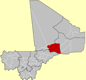
Cercle de Gourma-RharousPays  Mali
MaliRégion Tombouctou Chef-lieu Rharous Communes[1] Bambara Maoudé, Banikane, Gossi, Hamzakoma, Haribomo, Inadiatafane, Ouinerden, Rharous et Serere. Superficie 50,000 km² Population[2] Population 111,386 habitants (2009) Politique Président du conseil de cercle (élu(e) en 2009) modifier 
Le cercle de Gourma-Rharous est une collectivité territoriale du Mali dans la région de Tombouctou.
Géographie
Depuis 1999, le cercle de Gourma-Rharous est composée de 37 villages et 147 implantations et a été divisée en neuf communes rurales. Sa population est d'environ 100.000 et constituée principalement de nomades touaregs et Maure et les agriculteurs Songhay. Le chef lieu est Gourma-Rharous, qui a une population d'environ 3.000. Le cercle est adapté pour les chèvres, de moutons et de chameaux. D'autres bétail sont également élevés.
Gossi, situé dans le centre de la région, est un trou d'eau utilisée par les nomades touaregs.
Histoire
Dans la fin des années 1970, les réfugiés de la sécheresse se sont installés à Gossi afin qu'ils puissent cultivé et pratiqué l'agriculture autour du lac.
Notes et références
- Loi N°99-035 du 10 août 1999 portant création des collectivités territoriales de cercles et de régions
- Résultats provisoires du Recensement général de la population et de l'habitat 2009 sur Institut national de la statistique (Mali), 2010. Consulté le 18 mars 2010

Wikimedia Foundation. 2010.