Nancowry
- Nancowry
-
Nancowry est une île de l'archipel des Nicobar dans le Golfe du Bengale.
Géographie
Cette section est vide, insuffisamment détaillée ou incomplète.
Votre aide est la bienvenue !
Nancowry, située dans le groupe des îles du centre, mesure 11,7 km de longueur et environ 7,5 km de largeur maximales pour une superficie de 67 km2. Elle est séparée de quelques centaines de mètres de l'île de Camorta.
Histoire
Cette section est vide, insuffisamment détaillée ou incomplète.
Votre aide est la bienvenue !
Wikimedia Foundation.
2010.
Contenu soumis à la licence CC-BY-SA. Source : Article Nancowry de Wikipédia en français (auteurs)
Regardez d'autres dictionnaires:
Nancowry — (Nankavri) refers both to a single island and to the group of adjoining islands that make up the central part of the Nicobar Islands chain, located in the northeast Indian Ocean between the Bay of Bengal and the Andaman Sea. The island itself is… … Wikipedia
Nancowry — Vorlage:Infobox Insel/Wartung/Bild fehlt Nancowry Gewässer Indischer Ozean Inselgruppe Nikobaren Geographische Lage … Deutsch Wikipedia
Nancowry tehsil — Nancowry is one of 2 local administrative divisions of the Indian district of Nicobar, part of the Indian union territory of Andaman and Nicobar Islands. It is a division known locally as a tehsil, roughly equivalent to a county in its range of… … Wikipedia
Central Nicobarese languages — Central Nicobarese Nancowry, Camorta, Katchal Spoken in India Region Camorta, Nancowry, Katchal, Trinket Islands, Nicobars Native speakers … Wikipedia
Nicobar Bulbul — Hypsipetes virescens redirects here. This may also (erroneously) refer to the Sunda Bulbul (Ixos virescens); see below for details. Nicobar Bulbul Conservation status Vulnerable (IUCN 3.1) … Wikipedia
Camorta (Insel) — Camorta Karte der Nikobaren Gewässer Indischer Ozean Inselgruppe … Deutsch Wikipedia
Nicobar Islands — Map of Nicobar Islands The Nicobar Islands (Hindi: निकोबार द्वीप समूह or नारिकेलद्वीप, [nɪkoːˈbaːr ˈd̪ʋiːp səˈmuːɦ], Bengali: নিকোবর দ্বীপপুঞ্জ, Tamil: நக்காவரம்) are an archipelagic island chain in the eastern Indian Ocean. They are located in… … Wikipedia
Austrian colonisation of Nicobar Islands — was a shortlived and unsuccessful attempt of Austrian Empire to make Nicobar Islands (an island chain in the eastern Indian Ocean) their colony. The colony was established in 1778. This had previously been a Danish colony and Austria established… … Wikipedia
Nikobaren — Karte der Nikobaren Gewässer Indischer Ozean Geographische Lage … Deutsch Wikipedia
Nicobarese languages — Nicobarese Ethnicity: Nicobarese people Geographic distribution: Nicobar Islands Linguistic classification: Austro Asiatic Nuclear Mon–Khmer Nico Monic … Wikipedia
 Inde
Inde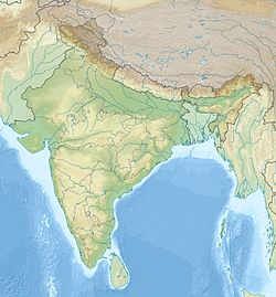
 Nancowry