District de Sudbury
- District de Sudbury
-
46° 50′ 51″ N 81° 33′ 51″ W / 46.8474, -81.5643
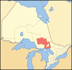
Localisation du district de Sudbury dans la province de l'Ontario
Le District de Sudbury est une division territoriale du nord-est de l'Ontario au Canada.
Le district de Sudbury fut créé en 1894 à l'est du district d'Algoma et à l'ouest du district de Nipissing.
Au recensement de 2006, la population s'élevait à 21 392 personnes, parmi laquelle on comptait 14 320 anglophones, soit 66 % de la population et 5 790 francophones, soit 27 % de Franco-Ontariens[1].
Le point culminant de la province, la crête Ishpatina (693 m) est situé dans le nord-est du district.
Municipalités
Villes
Cantons
Réserves indiennes
- Chapleau 74A
- Chapleau 75
- Duck Lake
- Mattagami
- Mountbatten
- Whitefish Lake
- Whitefish River
Territoire non organisé
Références
Wikimedia Foundation.
2010.
Contenu soumis à la licence CC-BY-SA. Source : Article District de Sudbury de Wikipédia en français (auteurs)
Regardez d'autres dictionnaires:
Sudbury — may mean:Places in Canada: *Greater Sudbury, Ontario (official name; the city continues to be known simply as Sudbury for most purposes):*Sudbury (electoral district), one of the city s federal electoral districts:*Sudbury (provincial electoral… … Wikipedia
Sudbury (electoral district) — Infobox Canada electoral district name = Sudbury province = Ontario caption = Sudbury in relation to other northern Ontario electoral districts fed status = active fed district number = 35088 fed created = 1947 fed abolished = fed election first … Wikipedia
Sudbury (provincial electoral district) — Infobox Canada electoral district name = Sudbury province = Ontario caption = prov status = active prov created = 1905 prov abolished = prov election first = 1905 prov election last = 2007 prov rep = Rick Bartolucci prov rep link = prov rep party … Wikipedia
Sudbury Catholic District School Board — Canadian School District schoolboardname = Sudbury Catholic District School Board additionalname = SCDSB imagesize = boardidentifier = officelocation = 165 D Youville St., Sudbury, Ontario communities = schoolcount = 24 budgetyear = 2006 2007… … Wikipedia
District de Manitoulin — 45°46′N 82°12′W / 45.767, 82.2 … Wikipédia en Français
Sudbury Public Schools — Infobox School name = Sudbury Public Schools location = 40 Fairbank Road Sudbury, Massachusetts 01776 country = USA type = Public school district grades = PK 8 enrollment = footnotes = website = [http://www.sudbury k8.org/ www.sudbury k8.org]… … Wikipedia
Sudbury, Unorganized, North Part, Ontario — Infobox City official name = Sudbury, Unorganized, North Part other name = native name = nickname = motto = imagesize = image caption = Railstop and HBC store in Gogama flag size = image seal size = image shield = shield size = image blank emblem … Wikipedia
Sudbury District — Lage des Sudbury District in Ontario Provinz Ontario Verwaltungssitz Espanola … Deutsch Wikipedia
Sudbury Hill tube station — Sudbury Hill is a London Underground station on the Uxbridge branch of the Piccadilly Line. The station is between Sudbury Town and South Harrow. It is located on Greenford Road north of the junction with Whitton Avenue. The station is in… … Wikipedia
Sudbury Town tube station — Sudbury Town is a London Underground station on the Uxbridge branch of the Piccadilly Line. The station is between Sudbury Hill and Alperton. It is located on Station Approach a short distance from the junction of Bridgewater Road (A4005) and… … Wikipedia

