- Altnaharra
-
Altnaharra
Allt na h-Eirbhe (gd)Administration Pays  Royaume-Uni
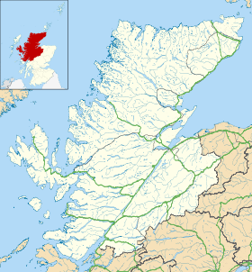
Nation constitutive Écosse Council area Highland Ancien comté Sutherland Code postal IV27Géographie Coordonnées Altitude 81 m Démographie Population 74 hab. (2004) Localisation Géolocalisation sur la carte : Highland
 Altnaharra
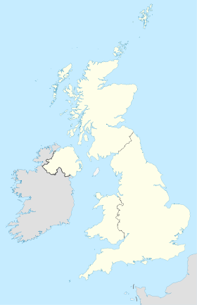
Géolocalisation sur la carte : Royaume-Uni
 Altnaharra
Altnaharra (gaélique d'Écosse Allt na h-Eirbhe, « brûlure du mur[1] »), parfois écrit Aultnaharra[2], est un hameau de 74 habitants du comté de Sutherland, situé dans les Highlands (nord de l'Écosse), le long de la route A836 reliant Tain à Tongue. Il tire son nom d'un ruisseau qui le traverse. Il se trouve à 81 mètres d'altitude[3].
Sommaire
Climat
Selon le Met Office, ce hameau détient le record de lieu le plus froid du Royaume-Uni, avec une température de -27,2 °C enregistrée le 30 décembre 1995[4]. C'est aussi à Altnaharra qu'a été relevée la température la plus froide de l'hiver 2009-2010, avec -22,3 °C le 8 janvier 2010[4] et également la journée la plus chaude pour un 20 mars (18,5° en 2009)[réf. nécessaire].
Patrimoine
Église d'Altnaharra
 Église d'Altnaharra.
Altnaharra possède une église presbytérienne construite entre 1854 et 1855 dont les formes de construction en font un des exemples les plus anciens d'églises écossaises édifiées à la mode anglaise ou galloise et non écossaise. On remarque notamment une grande chaire précédant un panneau et un double escalier[5].
Altnaharra Hotel
Altnaharra doit sa réputation au Altnaharra Hotel[6], ouvert en 1820 et bien connu des pêcheurs à la recherche de truites[7] qui viennent y séjourner lors de leur visite des lochs du Sutherland, notamment le loch Naver et le loch Eriboll. On louait déjà la qualité de cet hôtel en 1857[8]. Les alentours sont également fréquentés par des randonneurs qui se prêtent à l'ascension de deux sommets : le Ben Hope (927 m) et le Ben Klibreck (962 m).
Annexes
Notes
- (en) Place Names of Ross and Cromarty, William John Watson, 2008, p. 224.
- (en) The Gazetteer of Scotland, John E. Wilson, 1996, éd. WillowBendBooks.com, p.25.
- (en) Solar radiation & daylight models, Tariq Muneer, C. Gueymard, H. Kambezidis, Elsevier Ltd., Oxford, 2e éd>, 2004, p. 329.
- (en) « Big freeze brings coldest night », BBC, 8 janvier 2010
- (en) Buildings, faith and worship: the liturgical arrangement of Anglican Churches – 1600-1900, Nigel Yates, Oxford University Press, éd. révisée, 2000, p. xxxiii.
- (en) Altnaharra Hotel, site Internet de l'hôtel.
- (en) Little Rivers: A Book of Essays in Profitable Idleness, Henry Van Dyke, 2008, p. 96.
- (en) The angler and tourist's guide to the rivers, lakes and remarkable places in the Northern counties of Scotland, Andrew Young, Édimbourg, 1857, p. 45.
Catégorie :- Village d'Écosse


Wikimedia Foundation. 2010.