Amsterdamøya
- Amsterdamøya
-
Amsterdamøya est une petite île inhabitée située dans le nord-ouest du Svalbard et entourée par la banquise presque toute l'année.
Histoire
L'île a d'abord été découverte par Willem Barents en 1596, avant d'être explorée par les Néerlandais en 1614. Cette année-là, une expédition conduite par Willem Cornelis van Muyden et par Jan Jacobs May van Schellinkhout et commanditée par la Noordsche Compagnie, est chargée d'évaluer le potentiel de pêche à la baleine dans cette zone. C'est probablement à cette occasion que l'île a été nommée. En 1619, la Noordsche Compagnie construisent une station de chasse à la baleine temporaire, puis semi-permanente sur l'île. Celle-ci fut appelée Smeerenburg et a été abandonné vers 1660 suite au déclin de la pêche. Des hommes ont hiverné dans l'île durant l'hiver 1633-1634 afin de protéger la station d'éventuelles tentatives de pillages des rivaux basques et danois. Le deuxième hivernage, l'année suivante, se solda toutefois par une tragédie puisque les hommes sont morts de faim et de froid.
Un cimetière et les ruines de fours sont les seuls témoins subsistants de la présence néerlandaise du XVIIème siècle. Des chercheurs de l'Université de Groningue y ont effectué d'importantes recherches archéologiques.
Catégories :
- Île du Svalbard
- Île découverte en 1596
Wikimedia Foundation.
2010.
Contenu soumis à la licence CC-BY-SA. Source : Article Amsterdamøya de Wikipédia en français (auteurs)
Regardez d'autres dictionnaires:
Amsterdamøya — Smeerenburg Gewässer Arktischer Ozean Inselgruppe … Deutsch Wikipedia
Amsterdamoya — Amsterdamøya 79°40′N 10°30′E / 79.667, 10.5 … Wikipédia en Français
Amsterdamøya — (English: Amsterdam Island ) is a small island off the northwest coast of Spitsbergen.HistoryAmsterdamøya was first seen by Willem Barents in 1596. The Dutch first occupied it in 1614 (the year in which it was probably named), building a… … Wikipedia
Amsterdam Island — Amsterdamøya 79°40′N 10°30′E / 79.667, 10.5 … Wikipédia en Français
Fairhaven, Svalbard — Fairhaven generally speaking is the area between Amsterdam and Danskøya and the mainland, while specifically it refers to the sound between Danskøya and the mainland (Albert I Land), in particular the strait between Moseøya and Danskøya. The… … Wikipedia
Амстердам (остров, Шпицберген) — У этого термина существуют и другие значения, см. Амстердам (значения). Остров Амстердам Amsterdamøya … Википедия
Amsterdam (disambiguation) — Amsterdam is the largest city in, and titular capital of, the Kingdom of the Netherlands.Amsterdam may also refer to: *New Amsterdam (disambiguation) or Nieuw AmsterdamIn geography: *Amsterdam (city), New York, a city in New York, United States… … Wikipedia
List of islands in the Arctic Ocean — This is a list of islands in the Arctic Ocean, classified by country.Canada*Canadian Arctic Archipelago **Queen Elizabeth Islands ***Axel Heiberg Island ***Ellesmere Island ***Devon Island ***Melville Island **Baffin Island **Banks Island… … Wikipedia
Northernmost settlements — Some of the northernmost settlements in the world are: Location Latitude Population Public Settlement? Active? Description Barneo, Arctic Ocean Ice Sheet 88°11 N 100 no yes Latitude as of April 2009 (varies), Russian Ice Camp, populated in summer … Wikipedia
Île Amsterdam — Not to be confused with the Amsterdam Island in the Svalbard archipelago, near Spitsbergen; see Amsterdamøya. New Amsterdam Île Amsterdam … Wikipedia
 Norvège
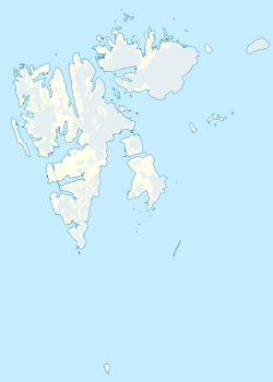
 Amsterdamøya