Kiewa
- Kiewa
-
36°07′S 146°56′E / -36.117, 146.933
La Kiewa est une rivière du Victoria et un des principaux affluents du Murray, le plus important fleuve d'Australie. La rivière fournit 40% de l'eau du fleuve.
Géographie
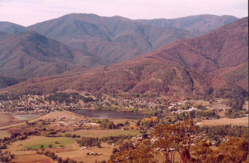
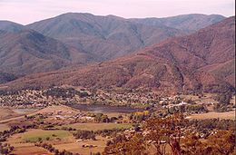
La rivière prend sa source près du Mont Bogong, dans les Alpes victoriennes. C'est d'abord un torrent qui coule vers le nord sur une centaine de kilomètres avant de ralentir sa course et rejoindre le Murray à l'ouest d'Albury.
Le cours de la rivière est coupé près de sa source par des centrales hydroélectriques dont les deux principales sont « McKay Creek » et "West Kiewa".
Les deux cours d'eau qui forment la rivière, les Kiewa est et ouest coulent d'abord au milieu de forêts presque vierges d'eucalyptus jusqu'à leur confluent près du village de "Mount Beauty". De là la rivière va prendre un cours beaucoup plus calme, serpentant parmi les exploitations agricoles jusqu'à sa confluence avec le Murray.
La vallée de la Kiewa est occupée par quatre villages: Mount Beauty, Tawonga, Kiewa Township et Yackandandah .
Source
Notes et références
Catégories :
- Cours d'eau du Victoria
- Système hydrologique du Murray-Darling
Wikimedia Foundation.
2010.
Contenu soumis à la licence CC-BY-SA. Source : Article Kiewa de Wikipédia en français (auteurs)
Regardez d'autres dictionnaires:
Kiewa — /ˈkiwɔ/ (say keewaw) noun a river in north eastern Victoria which rises in the Barry Mountains near Mounts Hotham and Feathertop and flows north to meet the Murray near Albury; its waters support the Kiewa hydro electric scheme …
Kiewa River — in GundowringVorlage:Infobox Fluss/KARTE fehlt Daten … Deutsch Wikipedia
Kiewa Hydroelectric Scheme — The scheme as intended by the SECV in 1948 The Kiewa Hydroelectric Scheme is the largest hydro electric scheme in Victoria and the second largest in mainland Australia after the Snowy Mountains Scheme. The scheme is situated in the Australian… … Wikipedia
Kiewa-Sandy Creek Football Club — Infobox australian football club clubname = Kiewa Sandy Creek Football Club fullname = nicknames = Hawks position = 1 of 11 topgoalkicker = bestandfairest = founded = 1969 colors = Brown Gold league = Tallangatta District Football League chairman … Wikipedia
Kiewa River — The Kiewa River is a major tributary of the Murray River in Australia.The river s headwaters include Victoria s highest mountain, Mount Bogong, and wind their way north west about 100 kilometres, gradually slowing before joining the Murray east… … Wikipedia
Kiewa Valley Highway — Infobox Australian Road road name = Kiewa Valley Highway type = route route route photo = caption = Formerly length = 146 direction = North South start = finish = , Glen Valley, Victoria est = through = Dederang, Tawonga, Mount Beauty, Falls… … Wikipedia
Tallangatta & District Football League — The Tallangatta and District Football League is an Australian rules football competition in the district of north east Victoria and the southern/border region of the New South Wales Riverina.Fact|now|date=September 2008ClubsCurrent**Barnawartha… … Wikipedia
Murray Valley Highway — Murray Valley Highway … Wikipedia
Tangambalanga, Victoria — Infobox Australian Place | type = town name = Tangambalanga state = vic caption = lga = Shire of Indigo postcode = 3691 est = pop = 439 (2006)Census 2006 AUS | id = SSC26723 | name = Tangambalanga (State Suburb) | accessdate = 2007 10 01 | quick … Wikipedia
Murray River — For other uses, see Murray River (disambiguation). Coordinates: 35°33′32″S 138°52′48″E / 35.55889°S 138.88°E / 35.55889; 138 … Wikipedia
 Australie