Kat Hing Wai
Contenu soumis à la licence CC-BY-SA. Source : Article Kat Hing Wai de Wikipédia en français (auteurs)
Regardez d'autres dictionnaires:
Kat Hing Wai — (吉慶圍) is a famous Punti walled village in Yuen Long District of Hong Kong. It often mistakenly believed to be Hakka, whose people have similar traditions. However the Punti people were from Southern China and the first to settle in Hong Kong. Kat … Wikipedia
Walled villages of Hong Kong — Most of the walled villages in Hong Kong are located in the New Territories.A walled village (zh t|t=圍村) is a kind of traditional building which is completely surrounded by thick defensive walls, protecting the residents from the attack of wild… … Wikipedia
Yuen Long District — Infobox HK District official name = Yuen Long District map caption = Location in Hong Kong google = leader title = District Council Chairman leader name = Tang Siu tong, JP constituencies = 29 area note = area magnitude = area total = 138.43 area … Wikipedia
Tang Clan — The Tang Clan (zh cp|c=鄧族|p=Dèng zú) is one of the Great Five Clans (五大族) of Hong Kong. The others are Man (Wen), Hau (Hou), Pang (Peng) and Liu (Liao). The Tangs originated from Jishui (吉水) of Jiangxi province and are considered to be native… … Wikipedia
Kam Sheung Road Station — MTR infobox engname=Kam Sheung Road chiname=錦上路 livery=#BC6456 namecolour=white caption=Kam Sheung Road Station on a sunny day line=West Rail open=20 December 2003 code=KSR hours=0559/0029 district=Yuen Long area=Kam Tin KCR type=Elevated… … Wikipedia
History of Hong Kong — Hong Kong began as a coastal island geographically located in southern China. While pockets of settlements had taken place in the region with archaeological findings dating back thousands of years, regularly written records were not made until… … Wikipedia
Kam Tin — (zh t|t=錦田), or Kam Tin Heung (錦田鄉), is an area in the New Territories, Hong Kong. It is at the north of Tai Mo Shan and east of Yuen Long. It was formerly known as Sham Tin (岑田).Many of Kam Tin s residents are from the Tang Clan, who are of the… … Wikipedia
Historia de Hong Kong — La historia de Hong Kong comprende los hechos históricos que tuvieron lugar en la isla costera que se ubica en el sur de China. Mientras que en la región se realizaron asentamientos cuyos vestigios arqueológicos se remontan a miles de años,… … Wikipedia Español
Tong Lau — Nos. 600 626 Shanghai Street, in Mong Kok, Hong Kong. Tong Lau (唐樓) or Kee lau (Mandarin Chinese: Qilou) are tenement buildings built in late 19th century to the 1960s in Hong Kong, Macau, southern China and … Wikipedia
List of primary schools in Hong Kong — The list of primary schools in Hong Kong is arranged by 18 districts of Hong Kong. It includes government schools, aided schools, Direct Subsidy Scheme (DSS) schools, private schools, as well as English Schools Foundation (ESF) schools and other… … Wikipedia
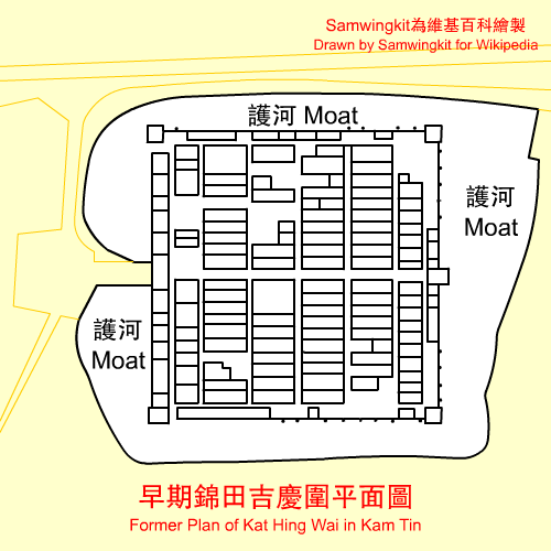
 Ancien plan de Kat Hing Wai
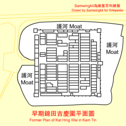
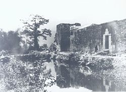 Kat Hing Wai dans les années 1920