Hinthada
- Hinthada
-
Henzada
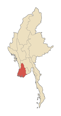
Henzada (ou Hinthada) est une ville de Birmanie (Myanmar) située au Nord-Est de la division d'Ayeyarwady. En 1983, l'aire urbaine d'Henzada comptait 311 336 habitants.
Située sur le bord de l'Irrawaddy, elle possède un port fluvial important pour l'exportation du riz et des céréales cultivées sur place. Elle abrite une université.
District de Henzada
Henzada est aussi le centre d'un des cinq districts et d'une des 25 municipalités de l'état.
- (en) Cet article est partiellement ou en totalité issu d’une traduction de l’article de Wikipédia en anglais intitulé « Hinthada ».
17°38′N 95°28′E / 17.633, 95.467
 Portail de la Birmanie
 Portail de la géographie
Catégories : Ville du Myanmar | Port fluvial | Subdivision du Myanmar
Wikimedia Foundation.
2010.
Contenu soumis à la licence CC-BY-SA. Source : Article Hinthada de Wikipédia en français (auteurs)
Regardez d'autres dictionnaires:
Hinthada — Infobox Settlement official name = Henzada other name = native name = nickname = settlement type = motto = imagesize = image caption = flag size = image seal size = image shield = shield size = image blank emblem = blank emblem type = blank… … Wikipedia
Hinthada — Original name in latin Hinthada Name in other language HEB, Henzada, Hintada, Hinthada State code MM Continent/City Asia/Rangoon longitude 17.64944 latitude 95.45706 altitude 15 Population 134947 Date 2012 12 09 … Cities with a population over 1000 database
Hinthada — ▪ Myanmar also called Henzada town, southwestern Myanmar (Burma). Hinthada is situated along the Irrawaddy River opposite Tharrawaw, with which it is linked by ferry, at a point considered to be the head of the Irrawaddy s delta. It is a… … Universalium
Hinthada Township — is a township of Hinthada District in the Ayeyarwady Division of Myanmar … Wikipedia
Hinthada District — is a district of the Ayeyarwady Division in south western Myanmar.TownshipsThe district contains the following townships: *Hinthada Township *Zalun Township *Laymyethna Township *Myanaung Township *Kyankhin Township *Ingapu Township … Wikipedia
Irrawaddy River — River, Myanmar (Burma). It flows 1,350 mi (2,170 km) across the centre of the country and empties into the Bay of Bengal. The country s most important commercial waterway, it is formed by the confluence of the Nmai and the Mali rivers; in the… … Universalium
Myanaung Township — မြန်အောင်မြို့နယ် Township Country … Wikipedia
Myanaung — Myanaung … Wikipedia
Irrawaddy River — Coordinates: 15°51′19″N 95°14′27″E / 15.85528°N 95.24083°E / 15.85528; 95.24083 … Wikipedia
Districts of Burma — Burma s states and regions are divided into 67 districts (Burmese: ခရိုင်; Burmese pronunciation: [kʰəjàiɴ]), which in turn are subdivided into townships then towns, wards and villages. Contents 1 List of districts by state or region … Wikipedia