- Herdland Township (Comté de Clay, Iowa)
-
Herdland Township Administration Pays  États-Unis
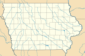
État  Iowa
IowaComté Comté de Clay Démographie Population (2000) 210 hab. Densité 2,3 hab./km² Géographie Coordonnées Superficie totale 92,12 km2 · dont terre 92,1 km2 (99,98 %) · dont eau 0,02 km2 (0,02 %) Fuseau horaire CST (UTC-6) 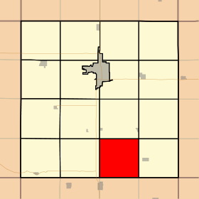


Herdland Township est un township du comté de Clay, situé en Iowa, États-Unis. La population était de 210 habitants lors du recensement de 2000.
Géographie
Herdland Township couvre 92,12 km² du comté de Clay et ne comporte aucune ville. Selon l'USGS, le township contient 3 cimetière : Burr Oak, Liberty et Osborn.
Les ruisseaux de Montgomery et de Willow coulent à travers ce township.
Catégories :- Comté de Clay (Iowa)
- Township de l'Iowa


Wikimedia Foundation. 2010.