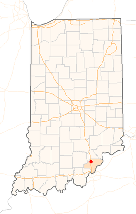
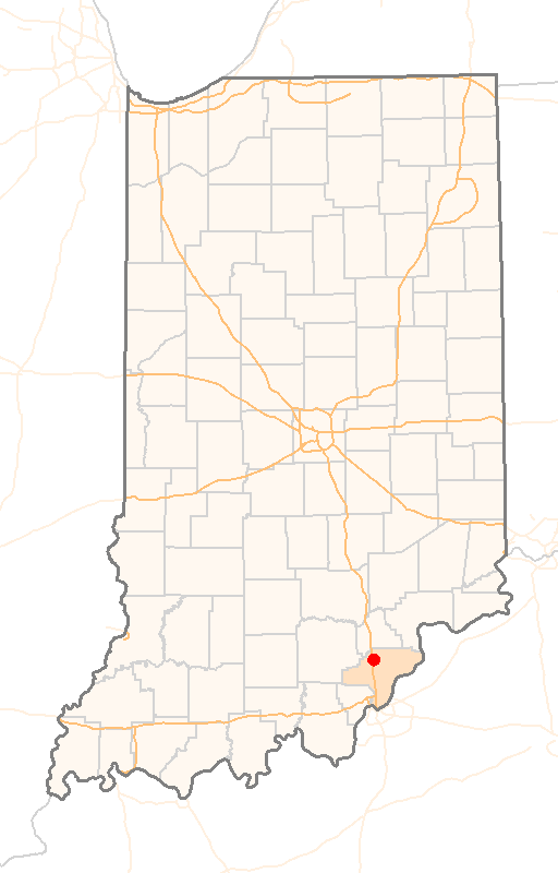
Henryville (Indiana)
Contenu soumis à la licence CC-BY-SA. Source : Article Henryville (Indiana) de Wikipédia en français (auteurs)
Regardez d'autres dictionnaires:
Henryville (Indiana) — Henryville Lugar designado por el censo de los Estados Unidos … Wikipedia Español
Henryville, Indiana — Infobox Settlement official name = CDP of Henryville, Indiana settlement type = CDP nickname = mapsize = 250x200px imagesize = image caption = imagesize = image caption = map caption = Location in the state of Indiana mapsize1 = map caption1 =… … Wikipedia
Indiana locations by per capita income — Indiana has the twenty seventh highest per capita income in the United States of America, at $20,397 (2000). Its personal per capita income is $28,783 (2003).Indiana Counties Ranked by Per Capita IncomeThere are ninety two counties located in… … Wikipedia
Henryville Jr/Sr High School — Infobox Secondary school name = Henryville Jr/Sr High School type = Public principal = Mr. Troy Albert students = grades = 7–12 city = Henryville state = Indiana country = United States district = West Clark Community Schools colors = Black and… … Wikipedia
Henryville — Henryville, IN U.S. Census Designated Place in Indiana Population (2000): 1545 Housing Units (2000): 609 Land area (2000): 2.884365 sq. miles (7.470472 sq. km) Water area (2000): 0.000000 sq. miles (0.000000 sq. km) Total area (2000): 2.884365 sq … StarDict's U.S. Gazetteer Places
Henryville, IN — U.S. Census Designated Place in Indiana Population (2000): 1545 Housing Units (2000): 609 Land area (2000): 2.884365 sq. miles (7.470472 sq. km) Water area (2000): 0.000000 sq. miles (0.000000 sq. km) Total area (2000): 2.884365 sq. miles… … StarDict's U.S. Gazetteer Places
Henryville — Cette page d’homonymie répertorie les différents sujets et articles partageant un même nom. Henryville peut correspondre à : Henryville, une ville de l État d Indiana au États Unis. Henryville, une municipalité du comté du Haut Richelieu au… … Wikipédia en Français
Indiana State Road 160 — Infobox road state=IN type=IN route=160 alternate name= length mi=26.6 length round=1 length ref= [http://illi indi.com/EndsPage.php?id=1160 section=1 Indiana Highway Ends SR 160] ] established= direction a=West starting terminus= junction=… … Wikipedia
List of high schools in Indiana — This is a list of high schools in the state of Indiana containing grades 9 12. A =Adams County= *Adams Central High School, Monroe, Adams County, Indiana *Bellmont High School, Decatur, Indiana *South Adams Jr./Sr. High School, Berne, Indiana… … Wikipedia
Clark County, Indiana — Clark County Courthouse in Jeffersonville, Indiana … Wikipedia
 Pour les articles homonymes, voir Henryville.
 États-Unis
 Indiana