Glen Burnie (Maryland)
Contenu soumis à la licence CC-BY-SA. Source : Article Glen Burnie (Maryland) de Wikipédia en français (auteurs)
Regardez d'autres dictionnaires:
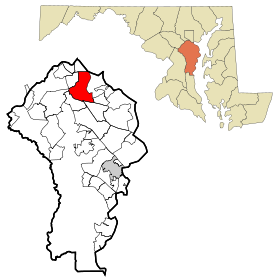
Glen Burnie, Maryland — Infobox Settlement official name = Glen Burnie, Maryland settlement type = CDP nickname = motto = imagesize = image caption = image imagesize = image caption = image mapsize = 250x200px map caption = Location of Glen Burnie, Maryland mapsize1 =… … Wikipedia
Glen Burnie — bezeichnet mehrere gleichnamige, im NRHP gelistete, Objekte: Glen Burnie (Kentucky), ID Nr. 79003618 Glen Burnie (Fluvanna County, Virginia), ID Nr. 00000893 Glen Burnie (Winchester County, Virginia), ID Nr. 79003305 Glen Burnie heißt ein Ort:… … Deutsch Wikipedia
Glen Burnie High School — Infobox Secondary school name = Glen Burnie High School logo = motto = established = 1923 type = Public secondary enrollment = 2,116 principal = Vickie Plitt grades = 9 12 address = 7550 B A Blvd city = Glen Burnie state = Maryland country =… … Wikipedia
Glen Burnie — Lugar designado por el censo de los Estados Unidos … Wikipedia Español
Glen Burnie — Glen Burnie, MD U.S. Census Designated Place in Maryland Population (2000): 38922 Housing Units (2000): 15902 Land area (2000): 12.231691 sq. miles (31.679933 sq. km) Water area (2000): 0.709104 sq. miles (1.836570 sq. km) Total area (2000):… … StarDict's U.S. Gazetteer Places
Glen Burnie, MD — U.S. Census Designated Place in Maryland Population (2000): 38922 Housing Units (2000): 15902 Land area (2000): 12.231691 sq. miles (31.679933 sq. km) Water area (2000): 0.709104 sq. miles (1.836570 sq. km) Total area (2000): 12.940795 sq. miles… … StarDict's U.S. Gazetteer Places
Cromwell Station / Glen Burnie (Baltimore Light Rail station) — Cromwell Station/Glen Burnie Baltimore Light Rail Station statistics Address … Wikipedia
Glen Burnie — /berr nee/ a city in E central Maryland, near Baltimore. 37,263. * * * … Universalium
Glen Burnie — uninc. place, NE Maryland 21061; pop. 37,305 … Webster's Gazetteer
Glen Burnie — /berr nee/ a city in E central Maryland, near Baltimore. 37,263 … Useful english dictionary
 États-Unis
 Maryland


