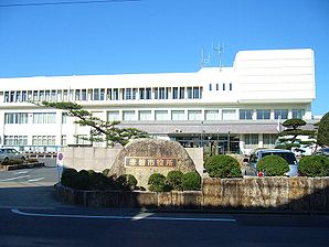
Akaiwa
- Akaiwa
-
Akaiwa (赤磐市, Akaiwa-shi?) est une ville située dans la préfecture d'Okayama au Japon.
Au 1er avril 2010, sa population s'élevait à 43 378 et sa densité à 207 personnes par km². Sa superficie totale est de 209.43 km².
Le 7 mars 2005, les villes de San'yō, Akasaka, Yoshii et Kumayama (toutes du district d'Akaiwa) fusionnèrent pour former la nouvelle ville d'Akaiwa.
Liens externes
Wikimedia Foundation.
2010.
Contenu soumis à la licence CC-BY-SA. Source : Article Akaiwa de Wikipédia en français (auteurs)
Regardez d'autres dictionnaires:
Akaiwa — shi 赤磐市 … Deutsch Wikipedia
Akaiwa District, Okayama — Akaiwa (赤磐郡; gun) was a district located in Okayama, Japan. As of 2004, the district has an estimated population of 14,945.The total area is 41.78 km². The district had only one town. * SetoOn January 22, 2007, the district dissolved when Seto… … Wikipedia
Akaiwa, Okayama — Infobox City Japan Name= Akaiwa JapaneseName= 赤磐 Map Region= Chūgoku Prefecture= Okayama District= Area km2= 209.43 PopDate= 2006 Population= 45,542 Density km2= 217.46 Coords= coord|34|45|N|134|1|E|region:JP type:city Tree= Flower= Bird= Symbol… … Wikipedia
Akaiwa Station — Infobox Station name= nihongo|Akaiwa Station|赤岩駅|Akaiwa eki type= image size= image caption= address= coordinates= coord|37.8057|140.335|display=inline,title line= other= structure= platform= depth= levels= tracks= parking= bicycle= baggage check … Wikipedia
Akaiwa-gun — Admin ASC 2 Code Orig. name Akaiwa gun Country and Admin Code JP.00.1865558 JP … World countries Adminstrative division ASC I-II
Akaiwa-shi — Admin ASC 2 Code Orig. name Akaiwa shi Country and Admin Code JP.31.7405227 JP … World countries Adminstrative division ASC I-II
District d'Akaiwa — Akaiwa (赤磐郡; gun) était un district situé dans la Préfecture d Okayama au Japon. En 2004, la population estimée du district s élevait à 14 945 personnes. La superficie totale était de 41.78 km². Le district n était composé que d une seule… … Wikipédia en Français
Yoshii, Okayama (Akaiwa) — was a town located in Akaiwa District, Okayama, Japan. On March 7, 2005, Yoshii merged with the towns of San yō, Akasaka, and Kumayama to form the new city of Akaiwa.As of 2006, the town had an estimated population of 5,386 and a density of 62.58 … Wikipedia
List of mergers in Okayama Prefecture — The following is a list of mergers that occurred in the 2000s in Okayama Prefecture, Japan.(as of January 22, 2007)Mergers from April 1, 1999 to March 31, 2000Mergers from April 1, 2000 to March 31, 2001Mergers from April 1, 2001 to March 31,… … Wikipedia
JP-33 — Karte Basisdaten Verwaltungssitz: Okayama Region: Chūgoku … Deutsch Wikipedia


